Backpacking – Cumberland Island Part 1

Never did I ever think I would have backpacking on my bucket list. Yet I have this crazy inner battle that encourages me to step outside my comfort zone and force myself to grow. It’s a weird thing that I can’t fully explain but wholeheartedly endorse. Part of it comes from a song lyric from Cruxshadows that grabbed me long ago and drives me: ”Look at your life, who do you want to be before you die?” It’s embedded in the goth version of a birthday song, so maybe not cheery, but it hits me at my core. So I fight my inner being filled with self-doubt and anxiety, and I push to be the confident adventurous person I want to be. The other part comes from knowledge that God created so many amazing things, people, & places on this Earth; I want to experience as much of it as possible. 

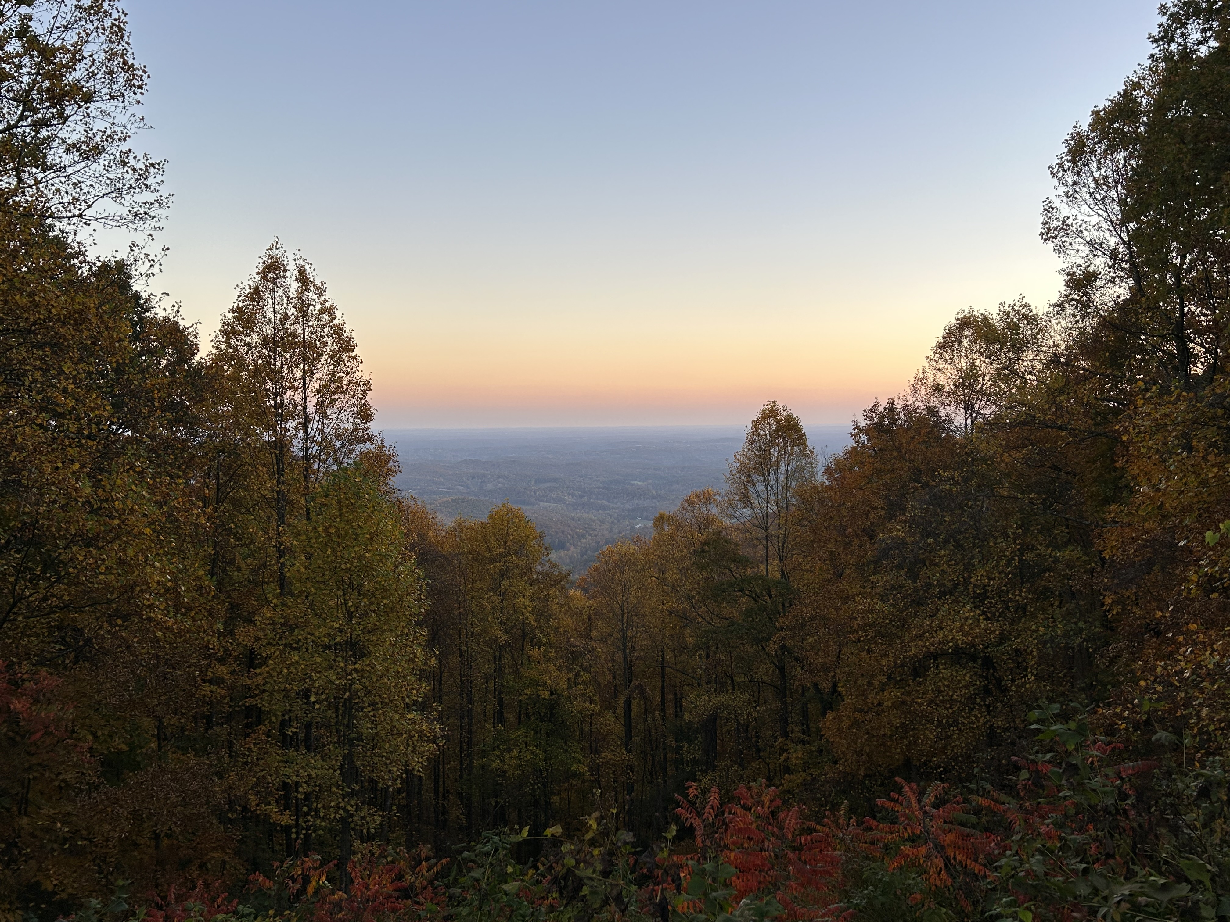
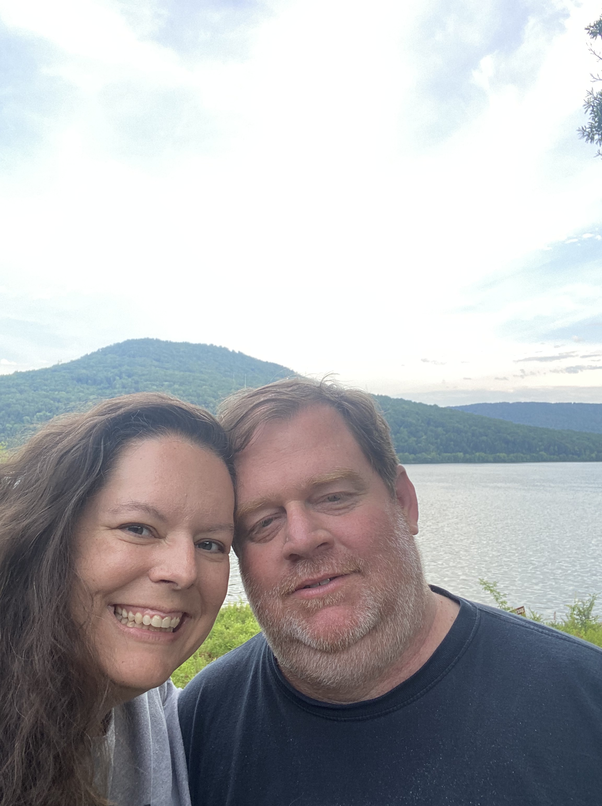
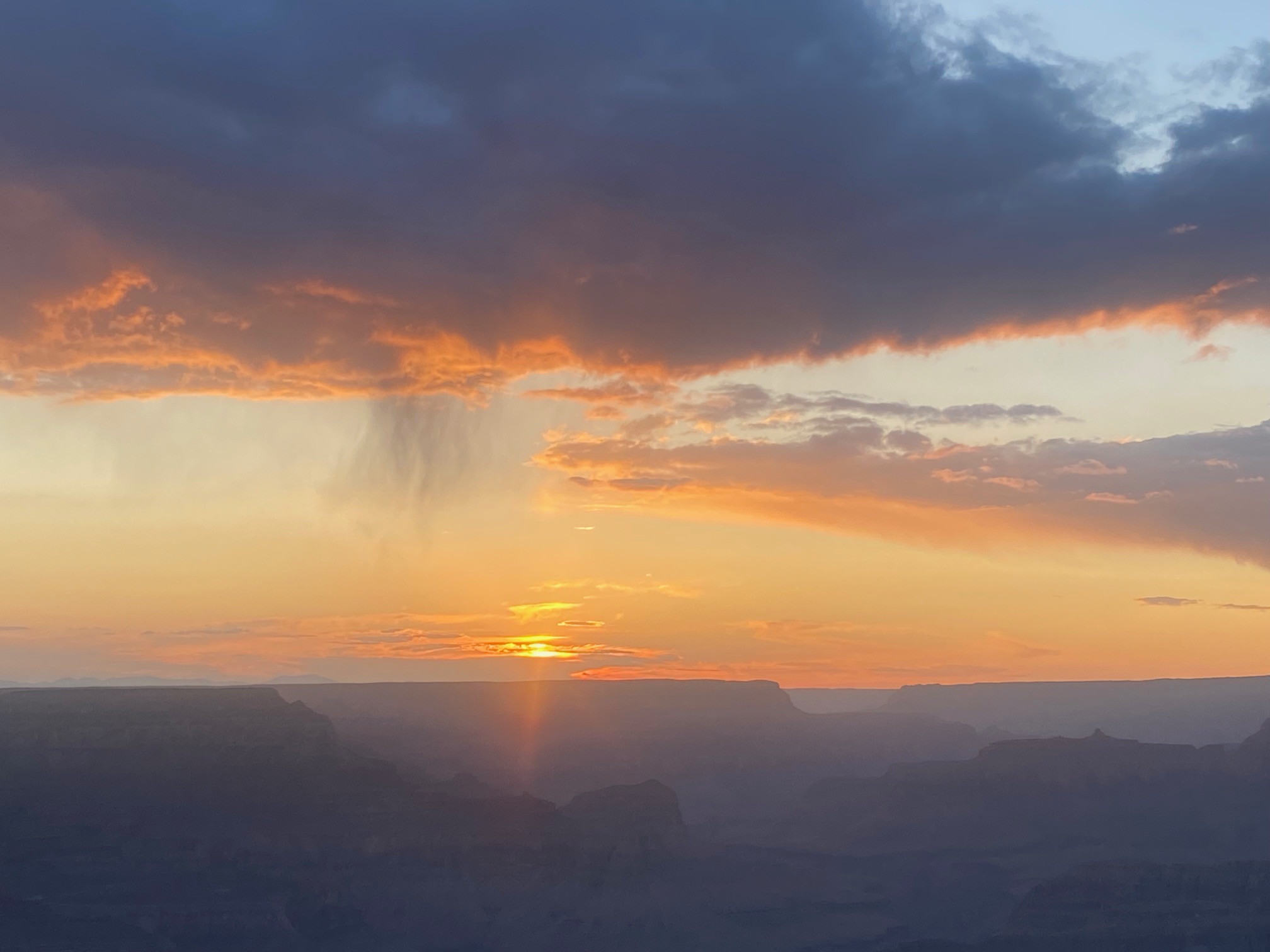
My dad loved backpacking and my boys did plenty of it through Scouts. I enjoy tent camping and day hikes, but never even considered pioneer camping, much less backpacking. It seemed unapproachable, undesirable, and beyond my physical ability. So how did this happen, you ask?? Back in late October, Thom & I went for an impromptu drive to chase the sunset, so to speak. I watched the sun set through the trees while we drove along the curvy roads of GA 60. As the light was nearly gone, we pulled over to a little parking area to enjoy those quiet moments between day and night. I was intrigued by this parking area in the middle of nowhere and had the realization that the AT (Appalachian Trail) probably crossed through the area. I pulled out my flashlight and investigated the area until I found a trail sign indicating we were at Woody Gap. The sign noted that we were 20 miles from Springer Mountain. I can’t explain it, but something took root in my mind as I remarked that Springer was the beginning of the AT and maybe I could do 20 miles. 

I promptly texted Brandon and asked if he wanted to hike the first 20 miles of the AT. He quickly responded “Sounds like a party.” Over the next few days, we decided we needed a test-run backpacking trip (as maybe 20 miles on the AT for a first time was not the best idea). We quickly honed in on Cumberland Island for a first trip due to mostly flat terrain and multiple options for stops/routes. I’ve been there for day trips before and loved it. Brandon went as a little guy and didn’t remember it at all. Last year we talked about planning a family trip to Cumberland, but that had fizzled out. I knew that December/January were the best months for Cumberland (due to ticks, mosquitos, etc) and that lined up well with us having time off from school & work. So, I put a bunch of gear on my Christmas list and we started planning.

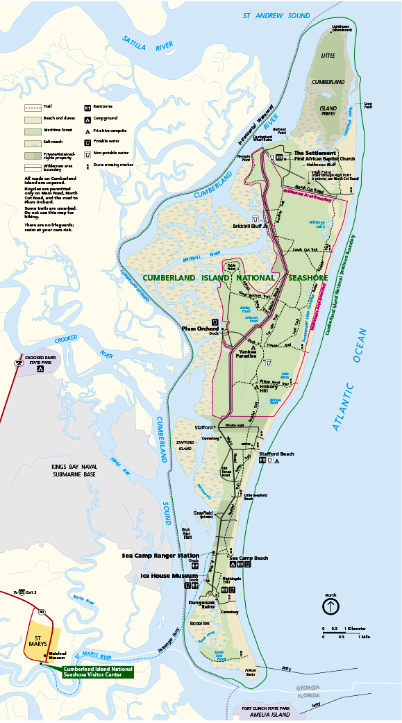
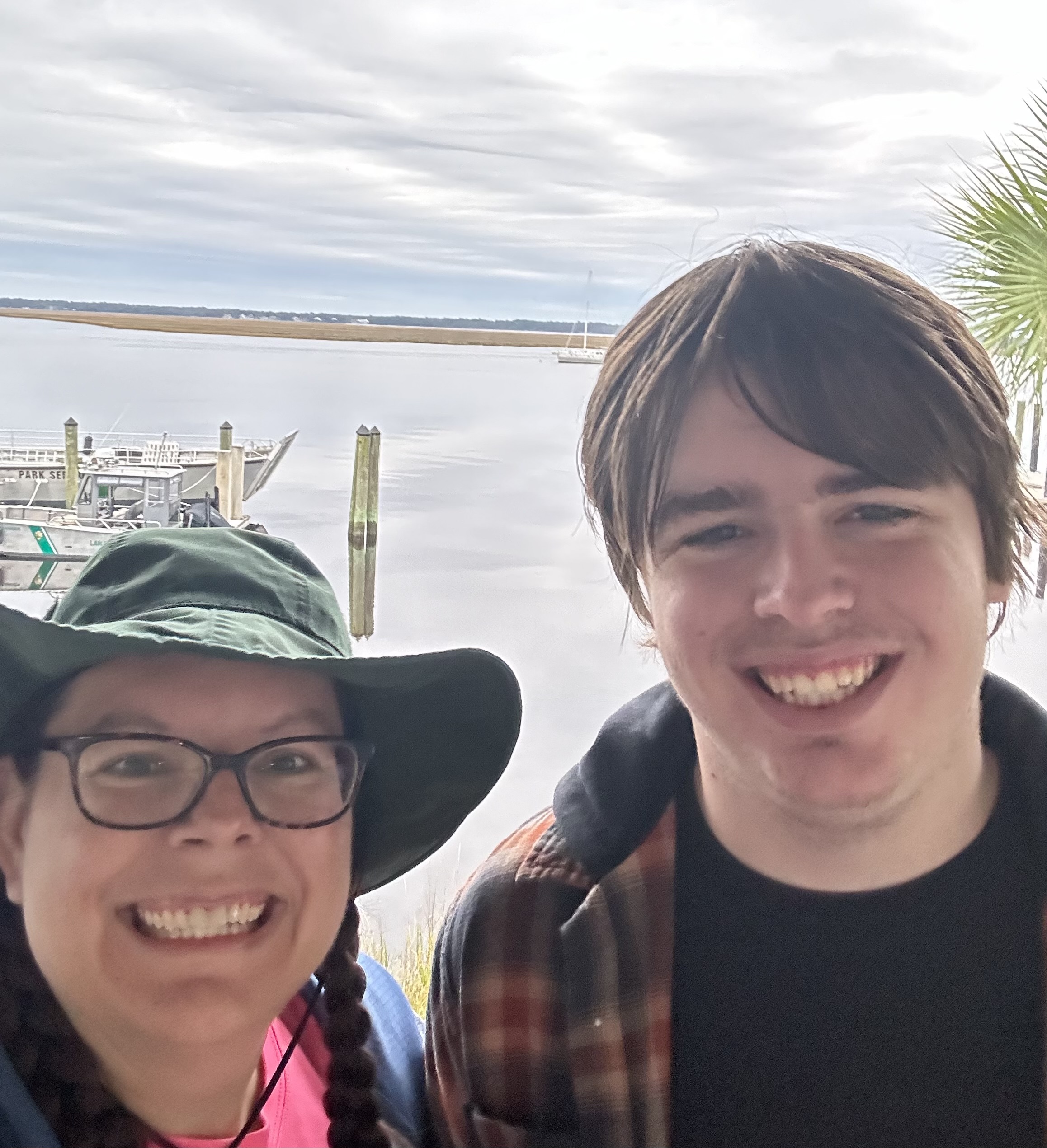
Upon making reservations on Cumberland, there were only two spots available and they were for the Hickory Hill camping area. It’s listed as 5.5 miles from the dock, so we knew we were in for a minimum 11 miles. It was both exciting and intimidating to study the map and look at possible treks over our three days on the island. The closer we got to the trip, the more anxious I felt. Some well-intentioned friends questioned the whole thing, but others were encouraging and supportive. I knew Brandon had lots of experience backpacking and he thought I could do this, so I leaned into his encouragement. We headed down to St. Marys on December 27th and had a big meal and a hotel stay the night before. The next morning, we checked in at 8am and prepared for the ferry ride over to the island.

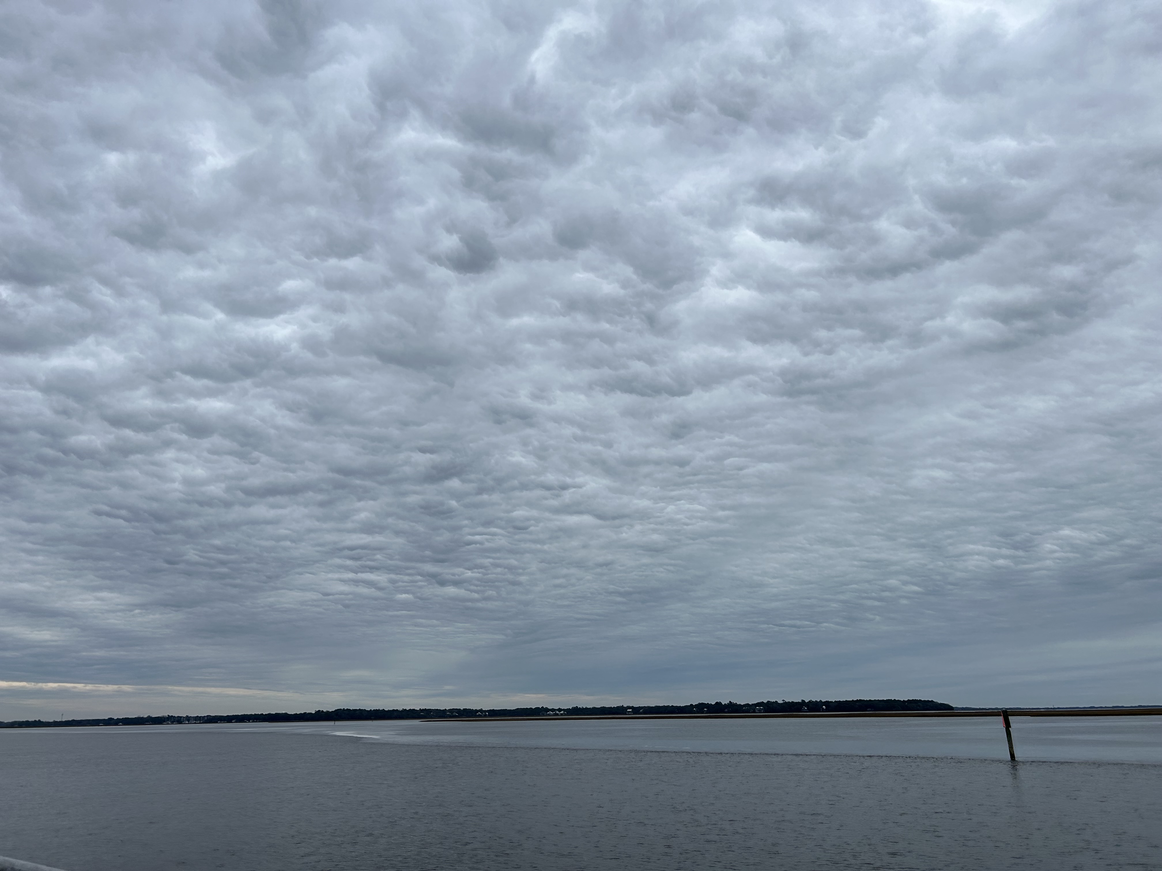
This is a good point to reveal a few things that already went sideways. First, I made an error in packing. I bought a second pair of cargo pants at the last minute, so at home I pulled out my backup leggings and replaced them with the new pants. When I double checked my backpack in the hotel, I realized I had not pulled out my black leggings but had instead pulled out my black turtleneck (my only long sleeve shirt). So, I got myself an early souvenir at the ferry check-in: a long sleeve shirt. Additionally, the forecast had changed a bit as we approached the trip, but things were still looking like the averages we expected: low chance of rain, lows in the upper 40s and highs in the upper 60s. The day before our trip, the forecast shifted significantly to be wetter and colder with high winds on days two and three.

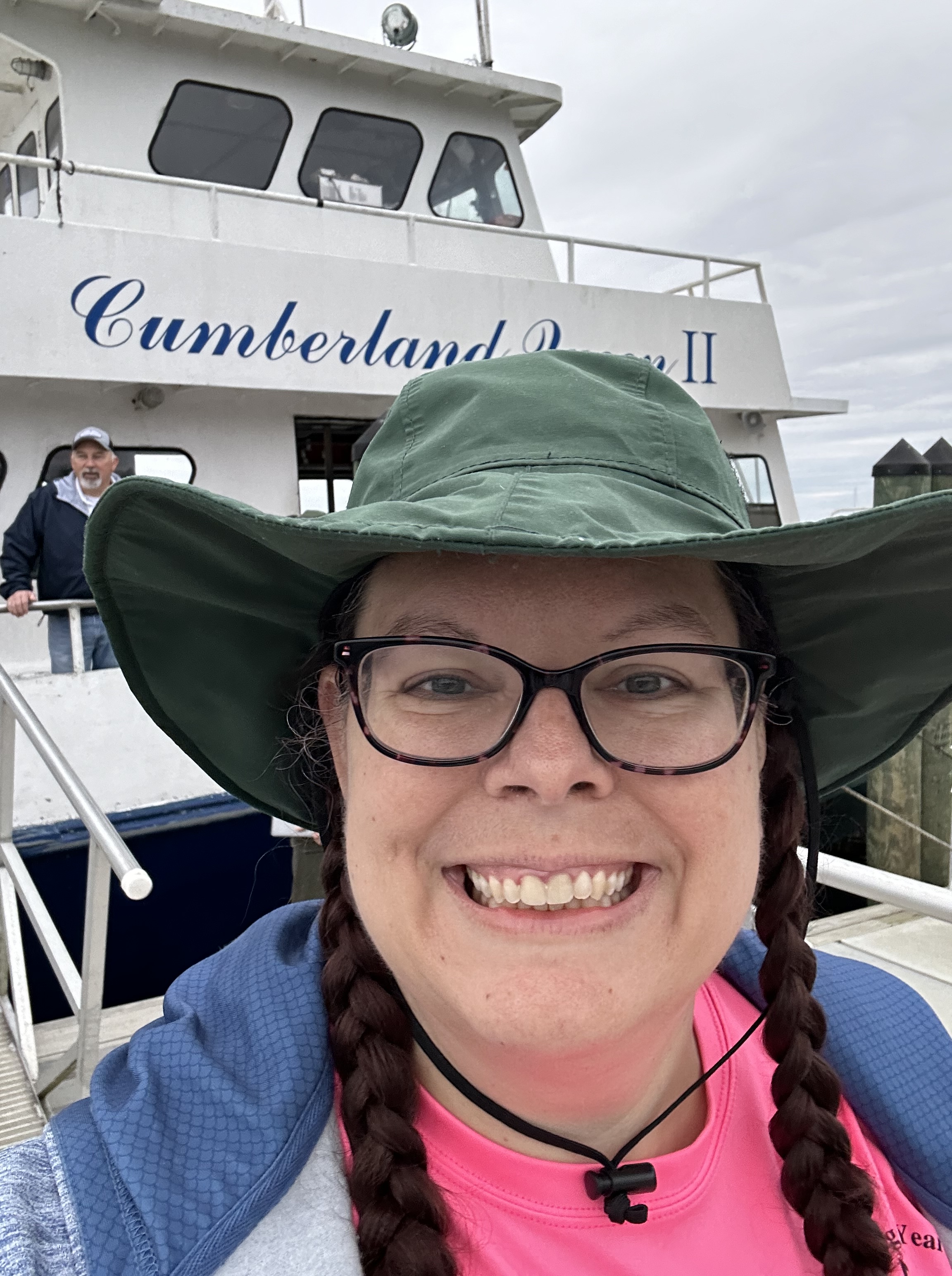
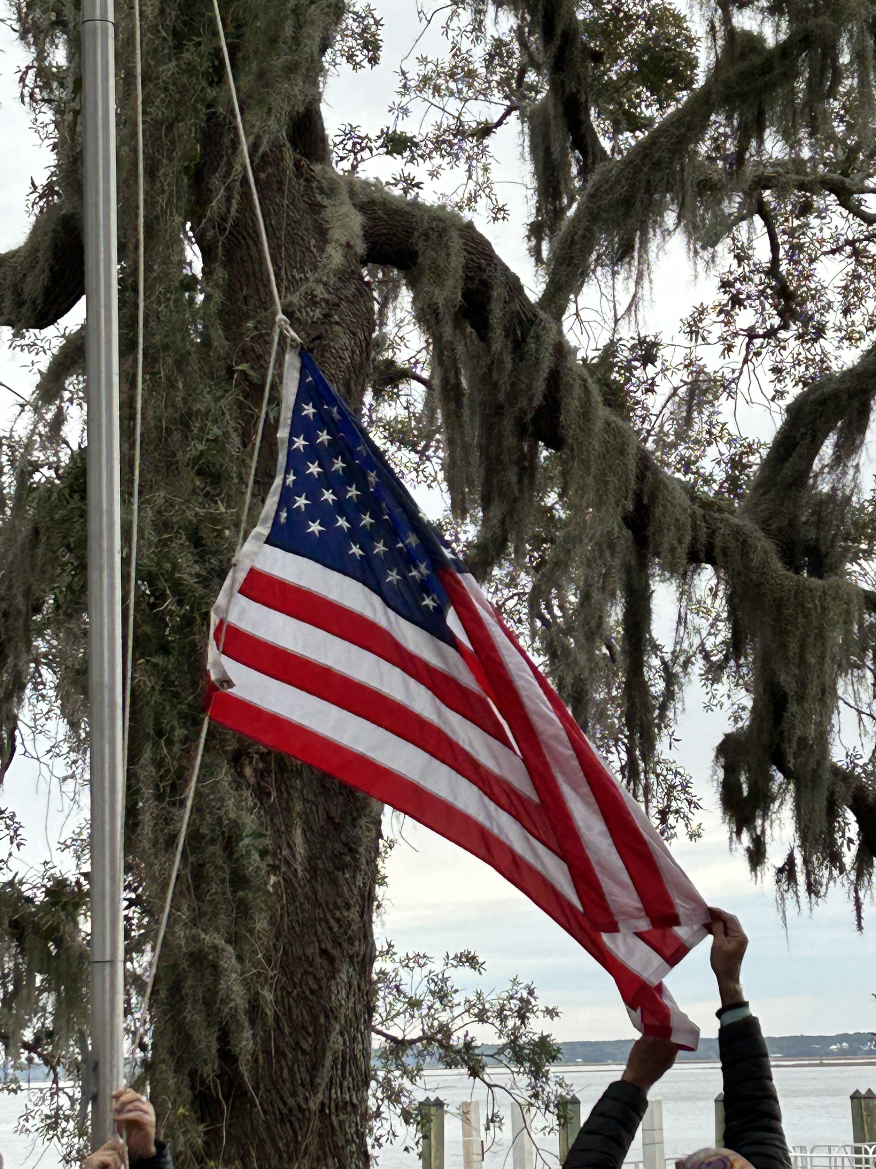
We pressed on and boarded the ferry for a 45 minute journey along the St. Marys River and across the Cumberland Sound. The water was shockingly still, it was chilly, and the cloudy skies looked ready for rain. Despite the nerves and the conditions, it was an enjoyable ride filled with bird sightings and even a few dolphins swimming ahead of the boat. We got off the ferry at the Sea Camp Dock amongst a driftwood beach, went through camping orientation, participated in the raising of the flag, and began the adventure.

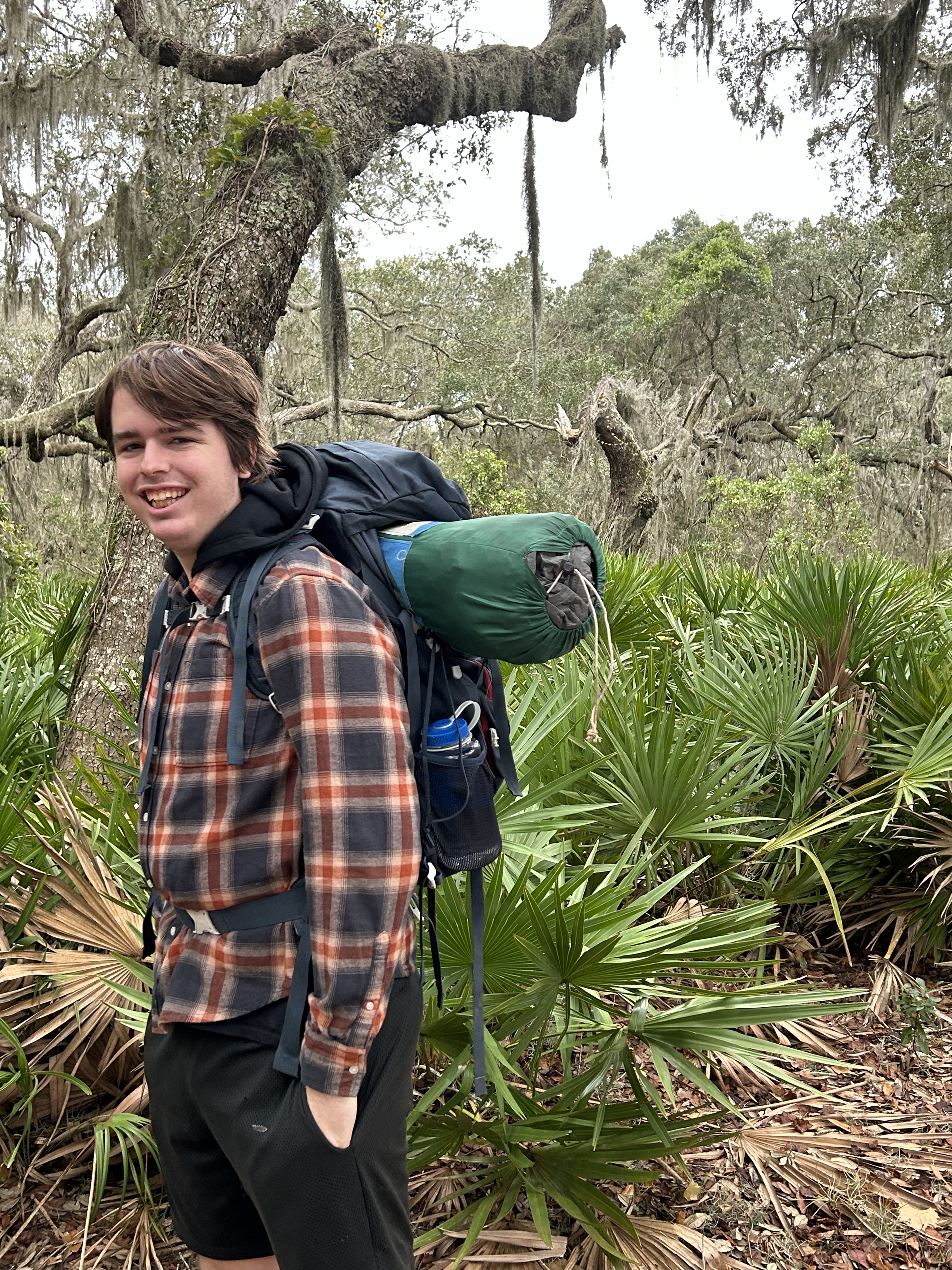
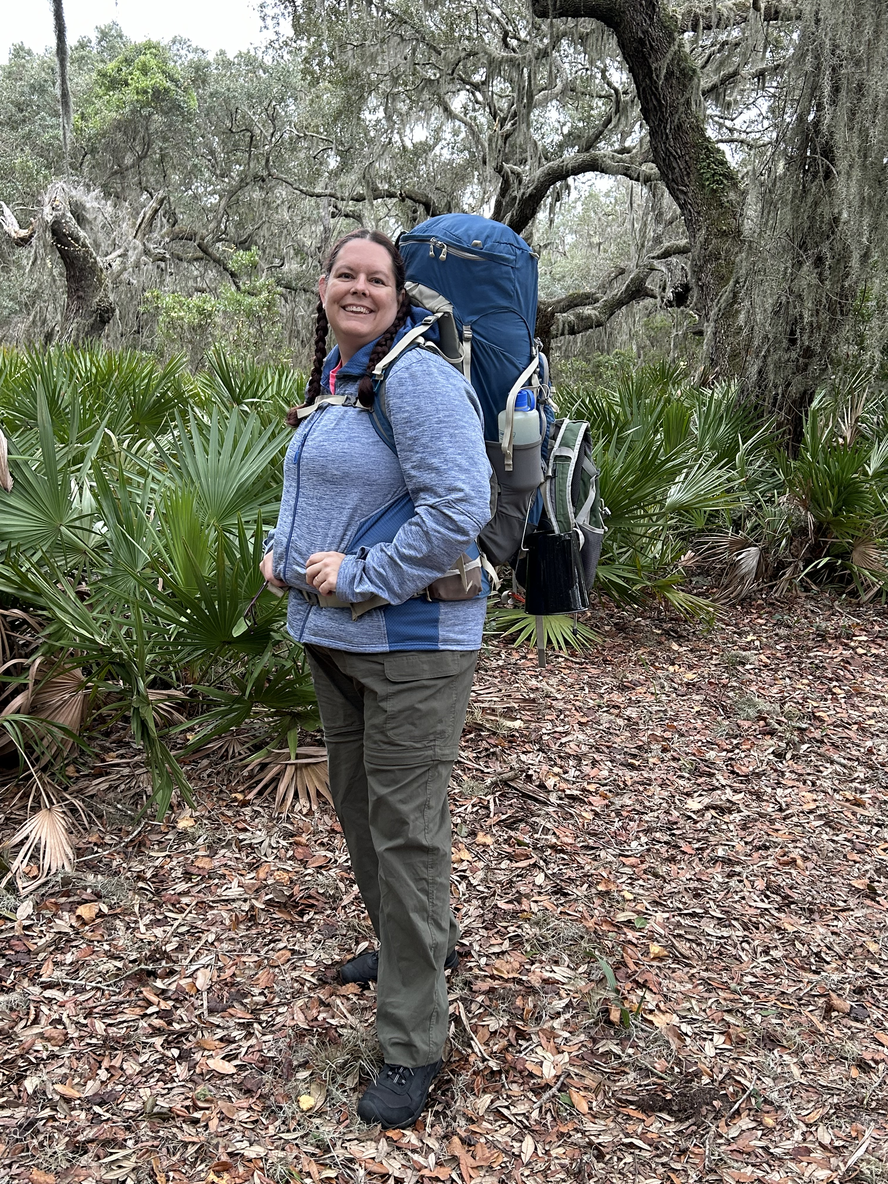
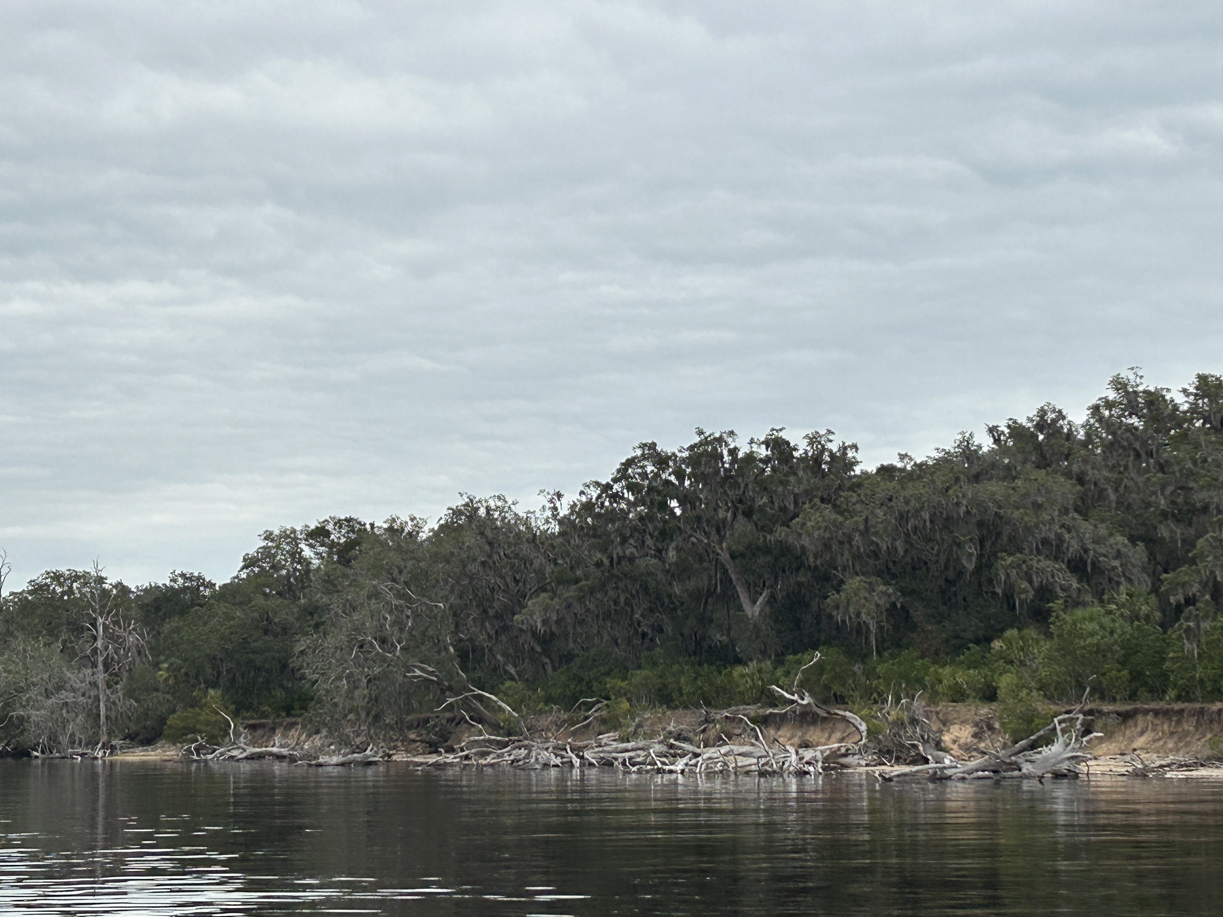
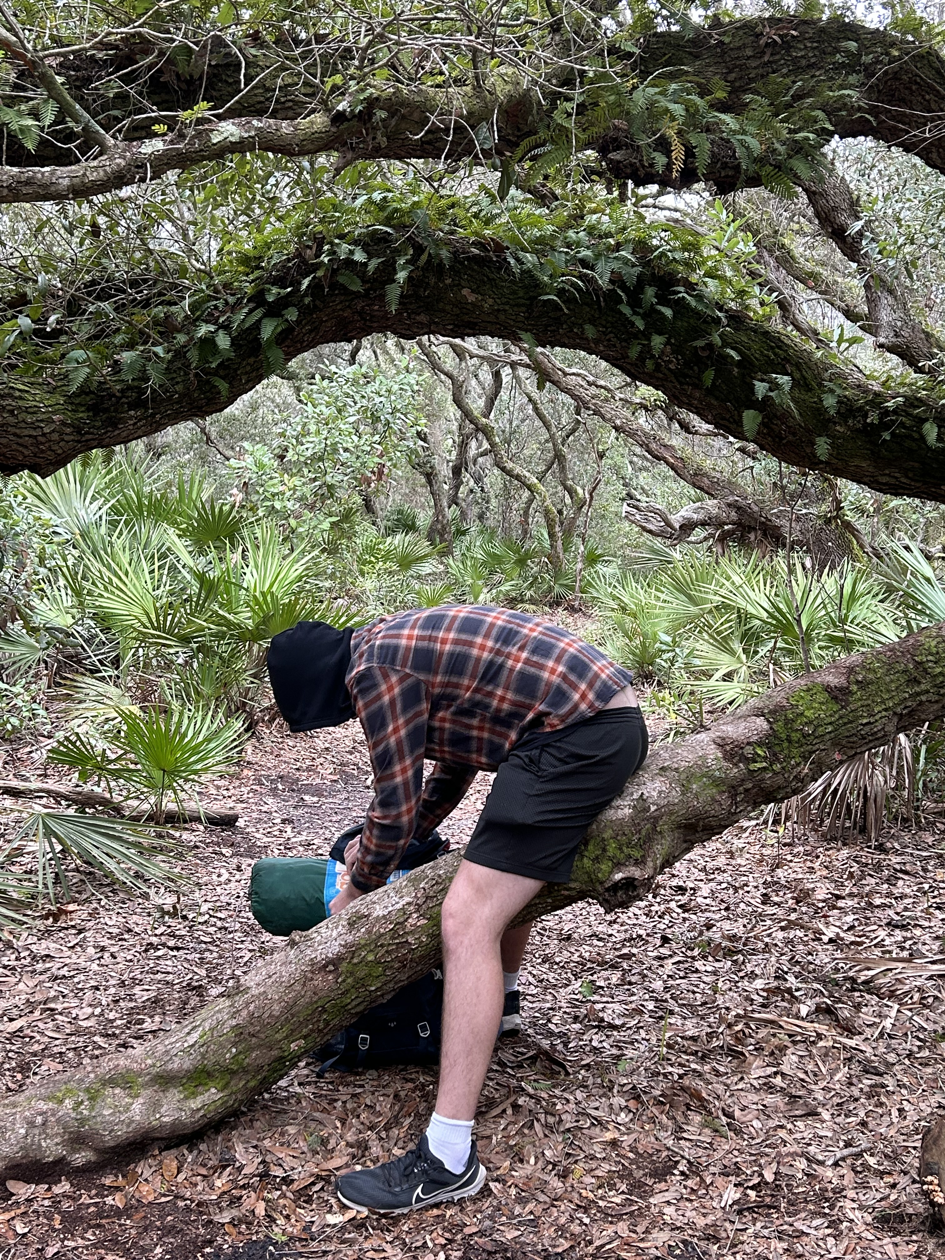
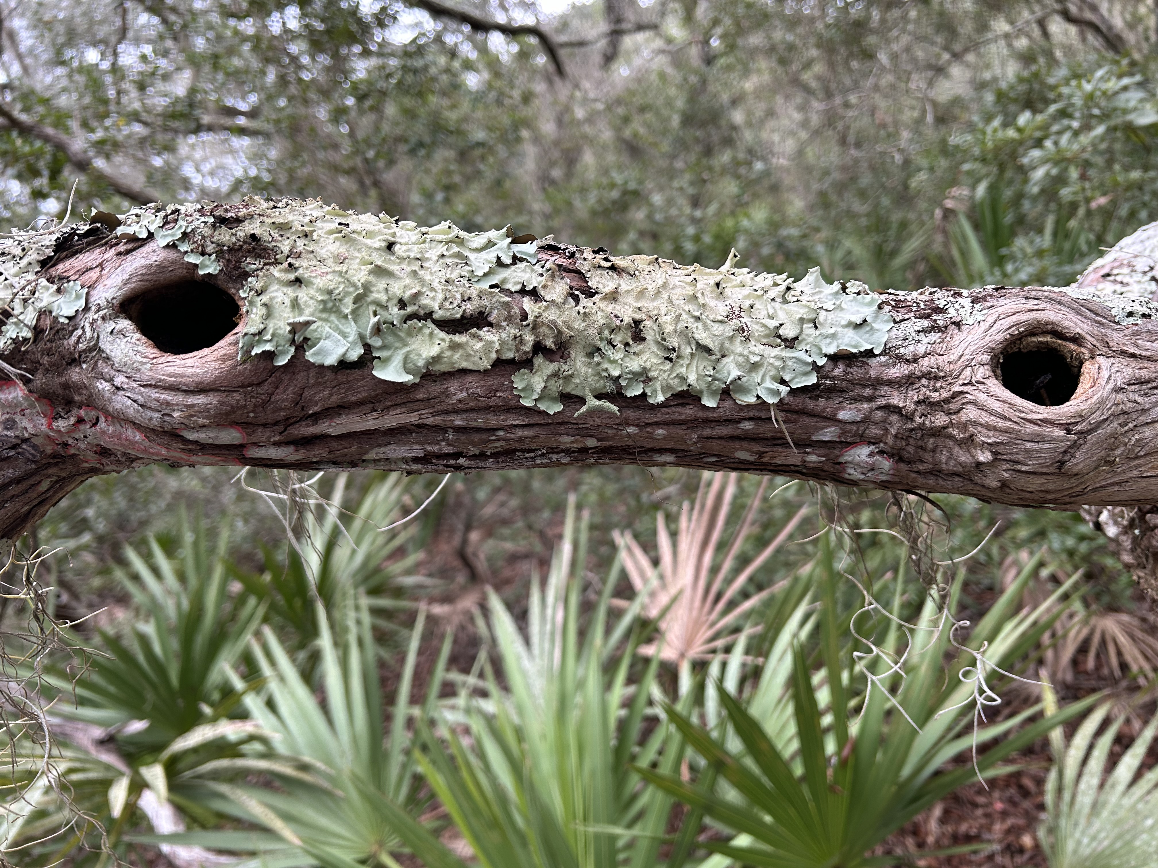
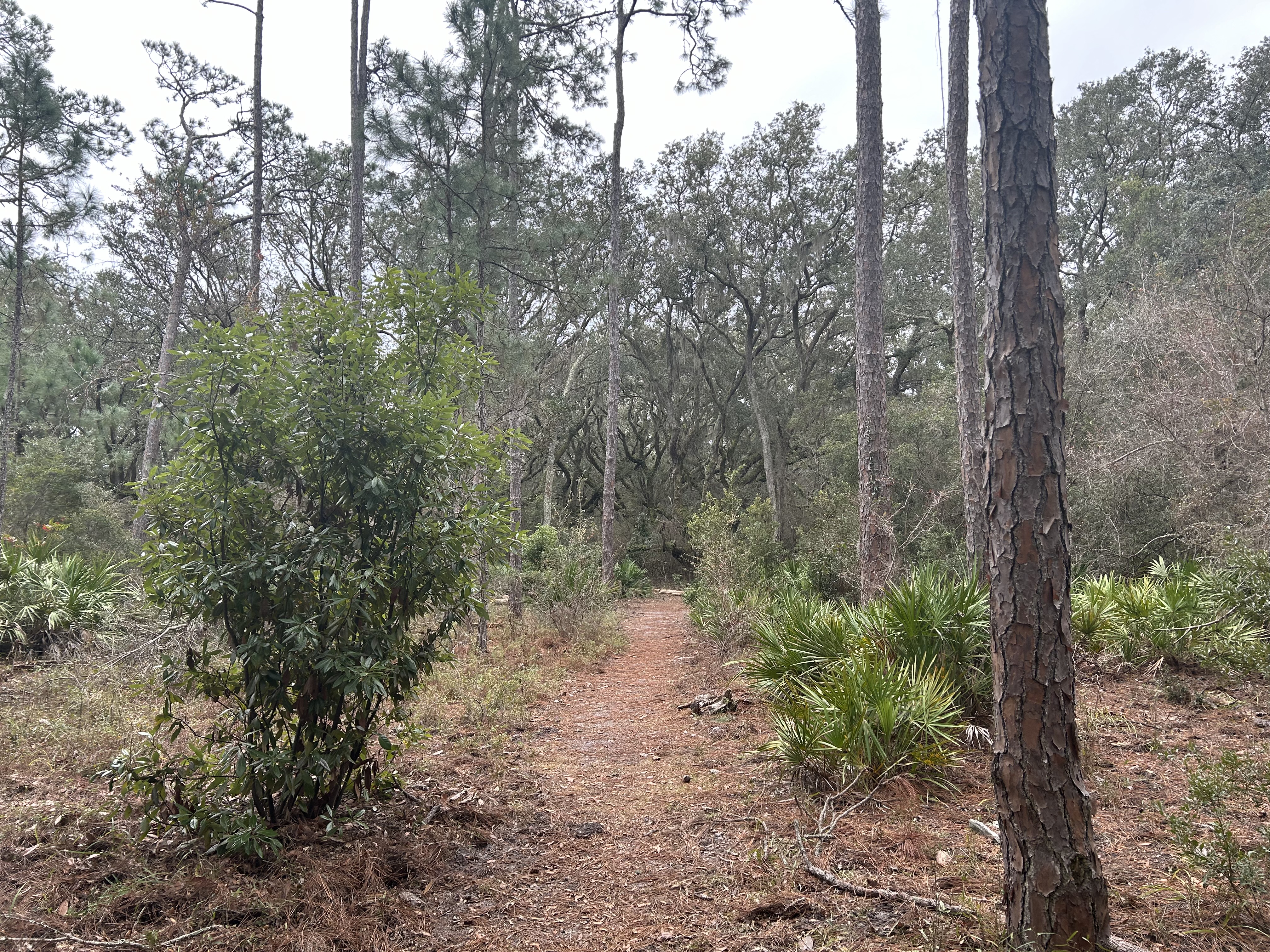
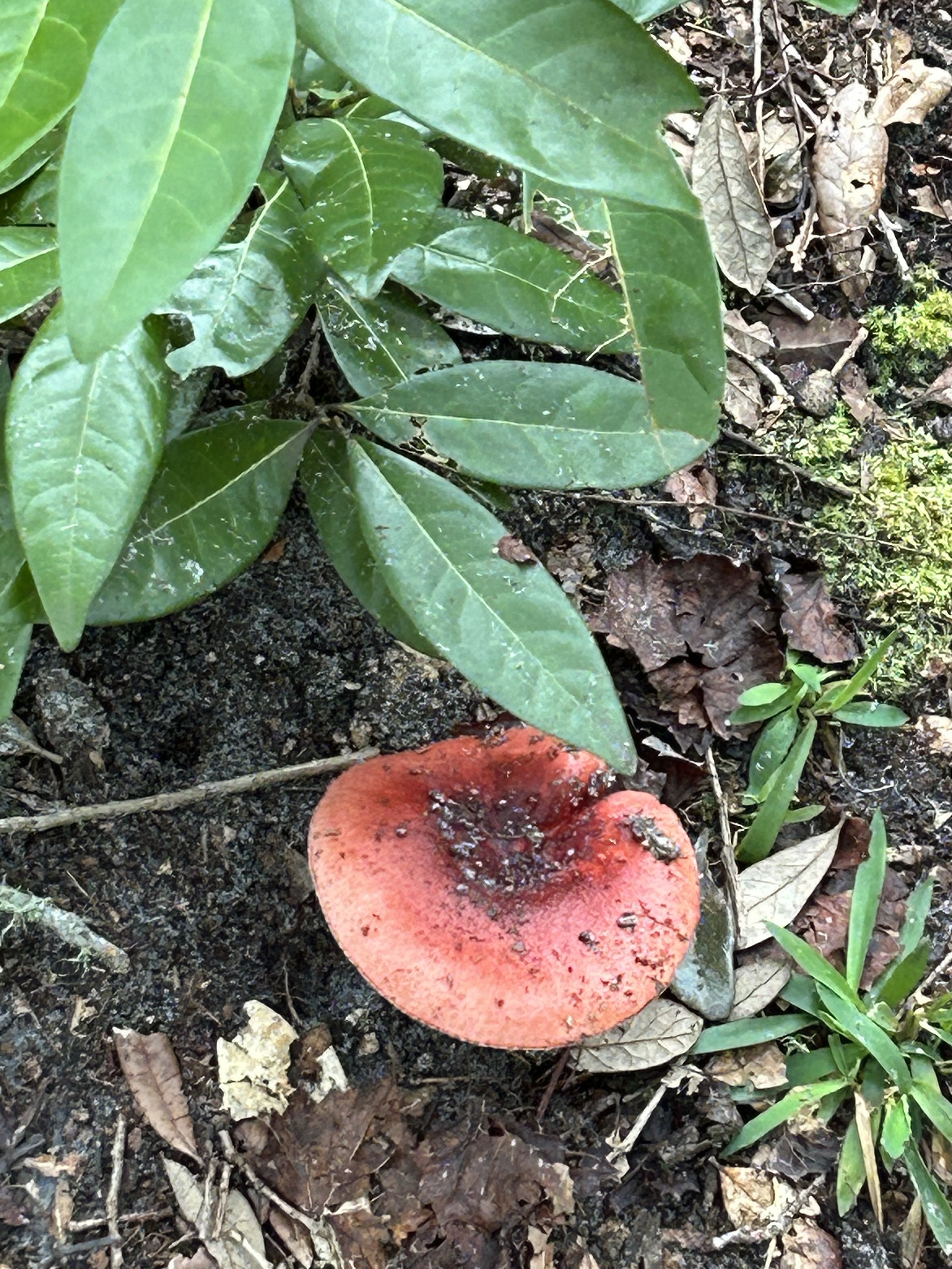
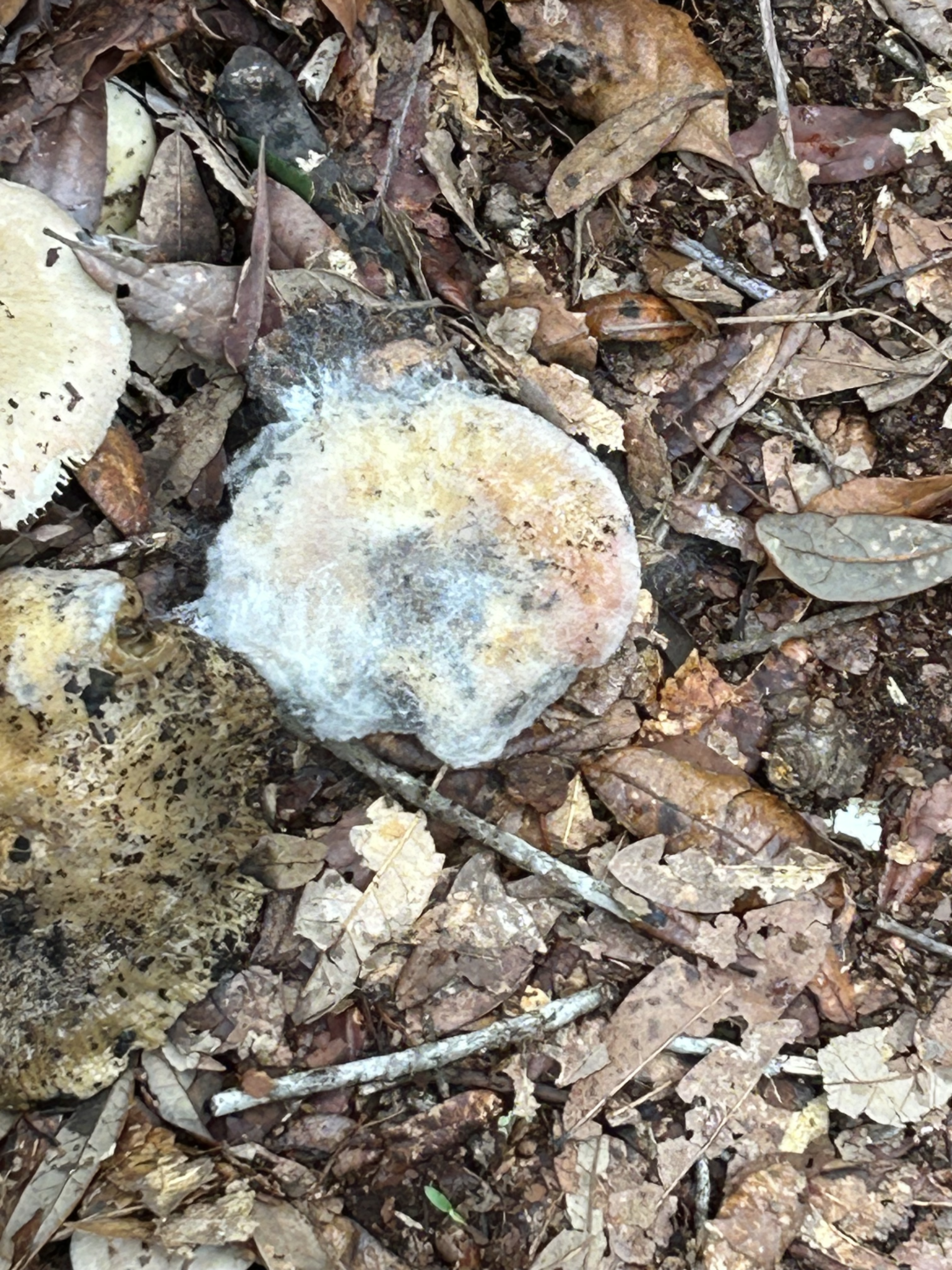
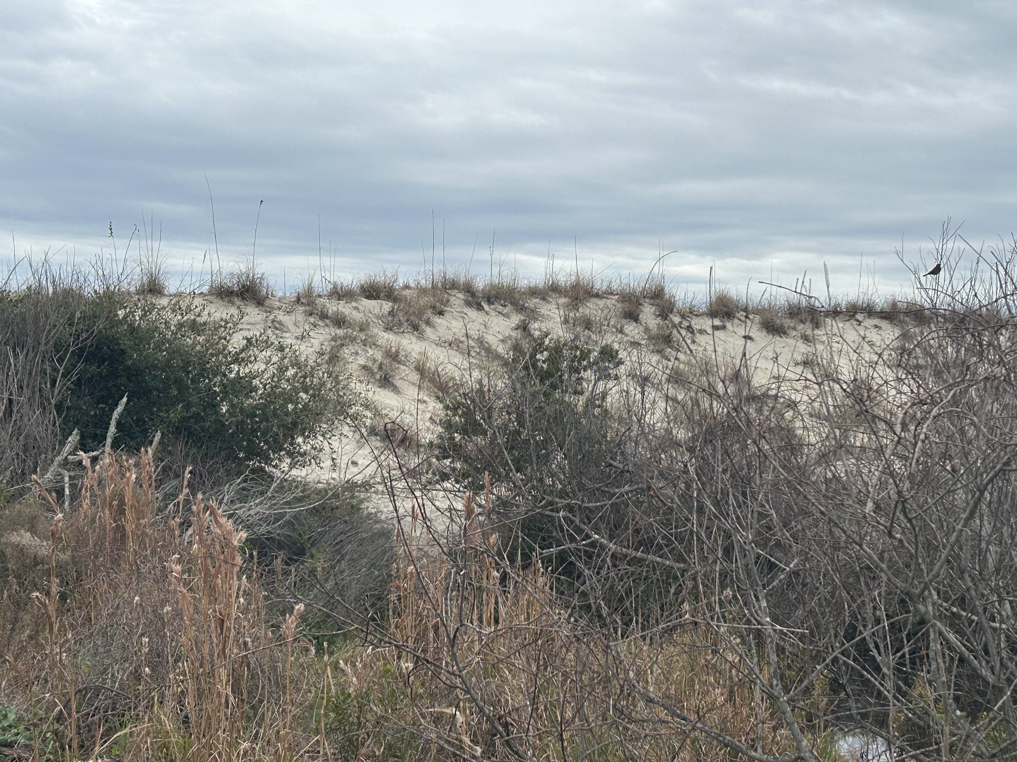
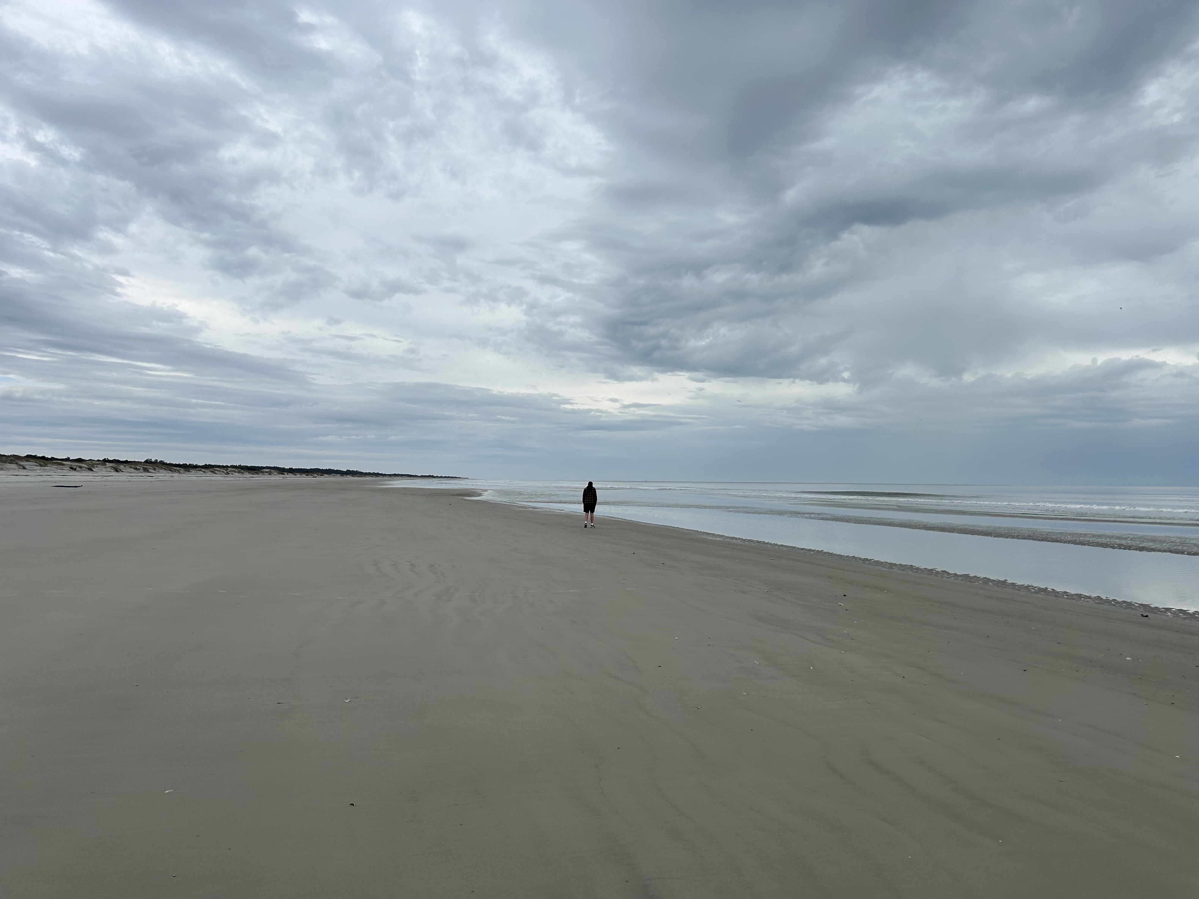
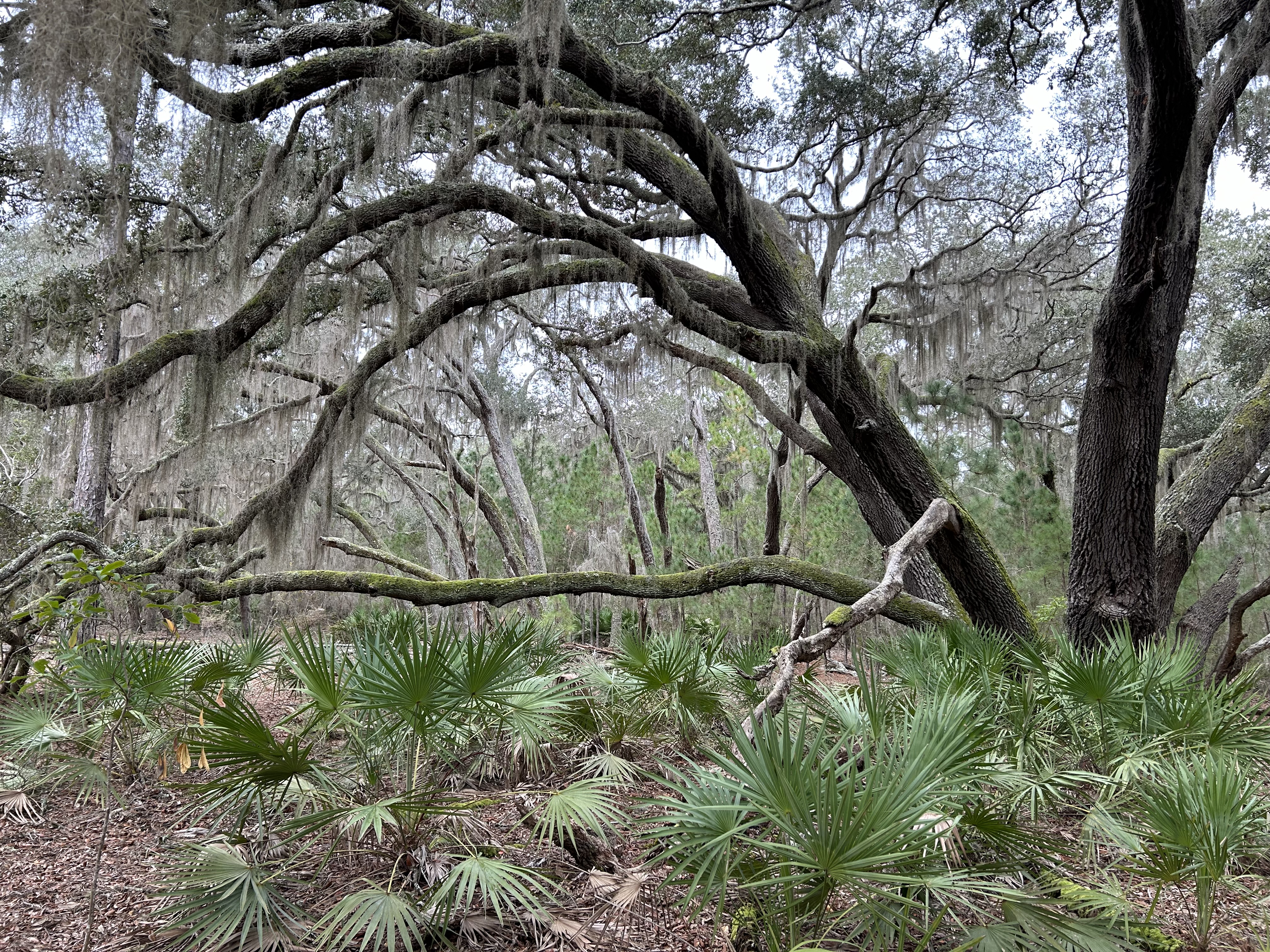
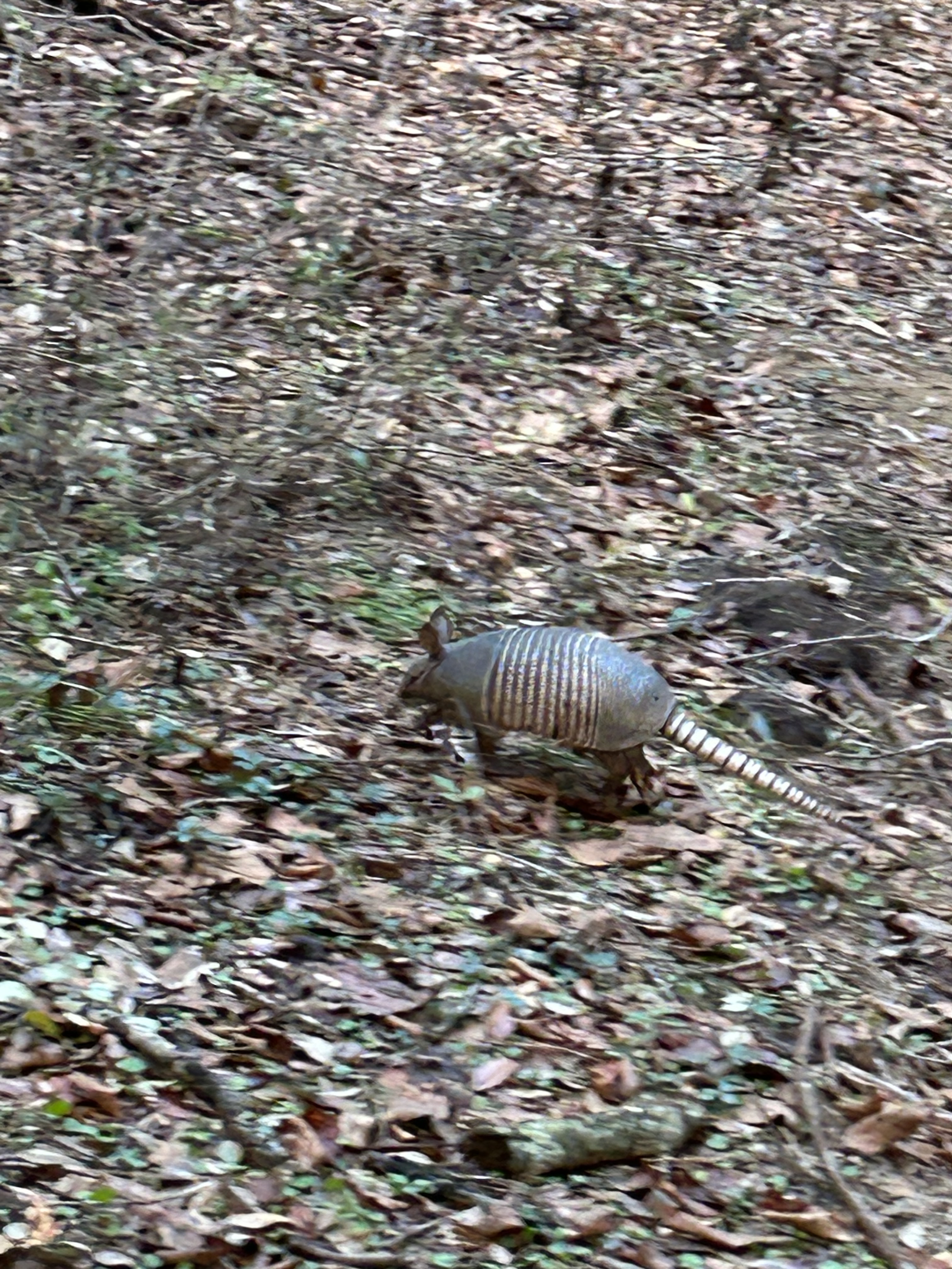
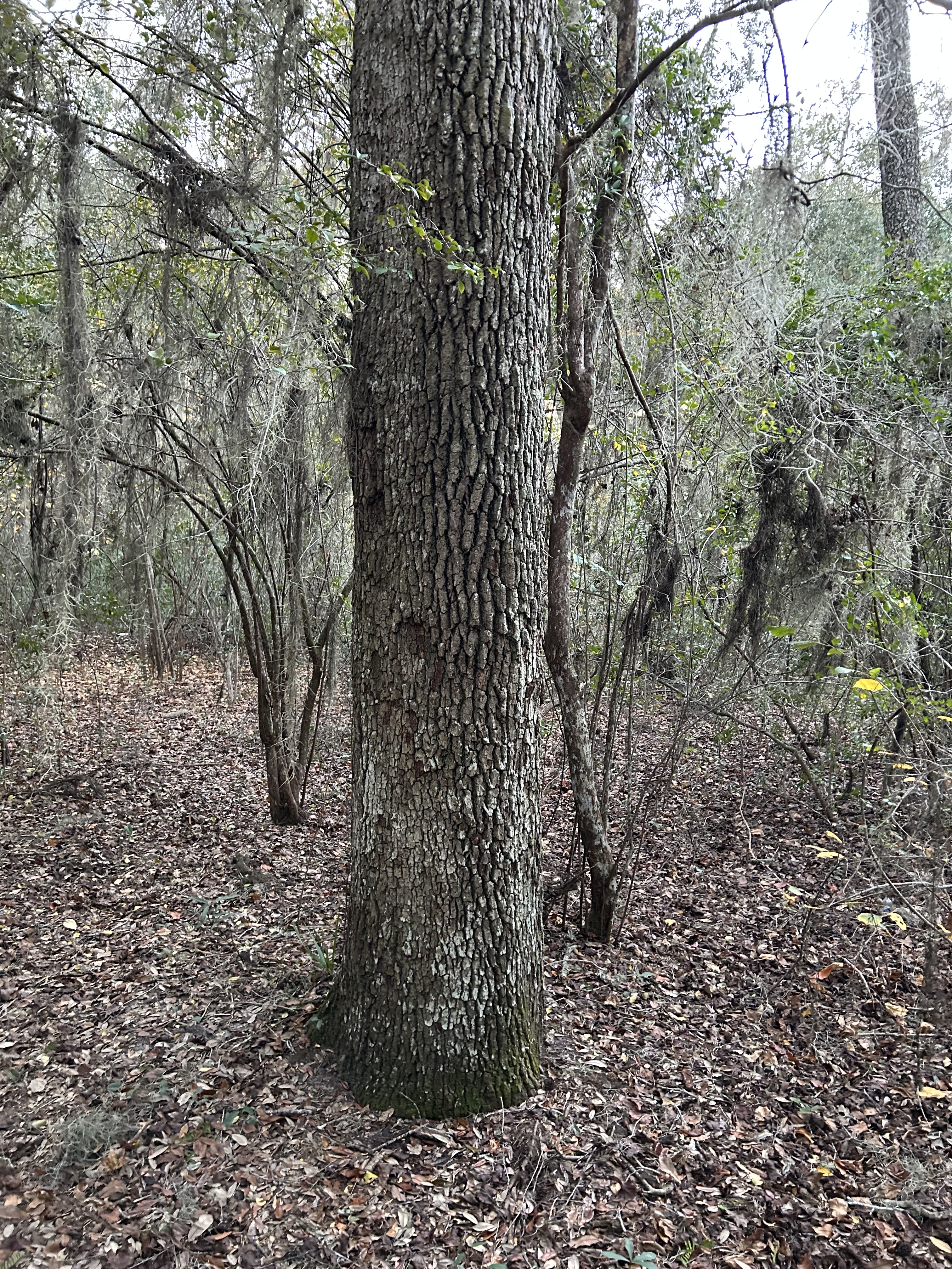
Based on the updated forecast, we decided that we’d better head over to the beach on our first day since it was likely the only day without high winds. (If you’ve been to a windy beach, you know that the sandblasting you receive is not enjoyable.) We headed off toward a lunch stop at Stafford Beach. The temperature was quite comfortable (low 60s) but it drizzled rain off and on throughout the day. We made it over the access trail to the Parallel Trail and were barely underway when the chest strap on my backpack broke. This was the strap that kept should straps flat against my chest, so while it wasn’t the end of the world, it certainly made for some extra difficulty over the next few days. We pressed on and, unlike our normal day hikes, we fell into a comfortable silence. It wasn’t long before Brandon stopped and pointed at the bushes. He heard and then spotted the first of many armadillos we would see during our days on Cumberland. They were funny little creatures scurrying along through the brush in search of bugs. If they spotted you, they would gallop away for just a moment before returning to their work. The island was spectacularly beautiful; we wandered among live oaks, Spanish moss, palmettos, ferns, and a wide variety of mushrooms. We encountered spaces where the jungle seemed to end and a pine forest would start (almost like someone drew a line in the land). We would go a little ways and it would suddenly change back. We encountered many branches stretching across the trail, some where you would have to climb over them and others where you would have to crawl under (which is challenging with a 35 pound bag on your back). As we crossed over to Pratts Trail, we decided to take a snack break at one of these areas with a low branch inviting us to take a load off. Our break tree also had a funny little branch with a “face”–there were fun details everywhere if you took the time to look. A mile later, we were at the Stafford Beach Campground where we could take our packs off, refill with potable water, and use a “real” bathroom.

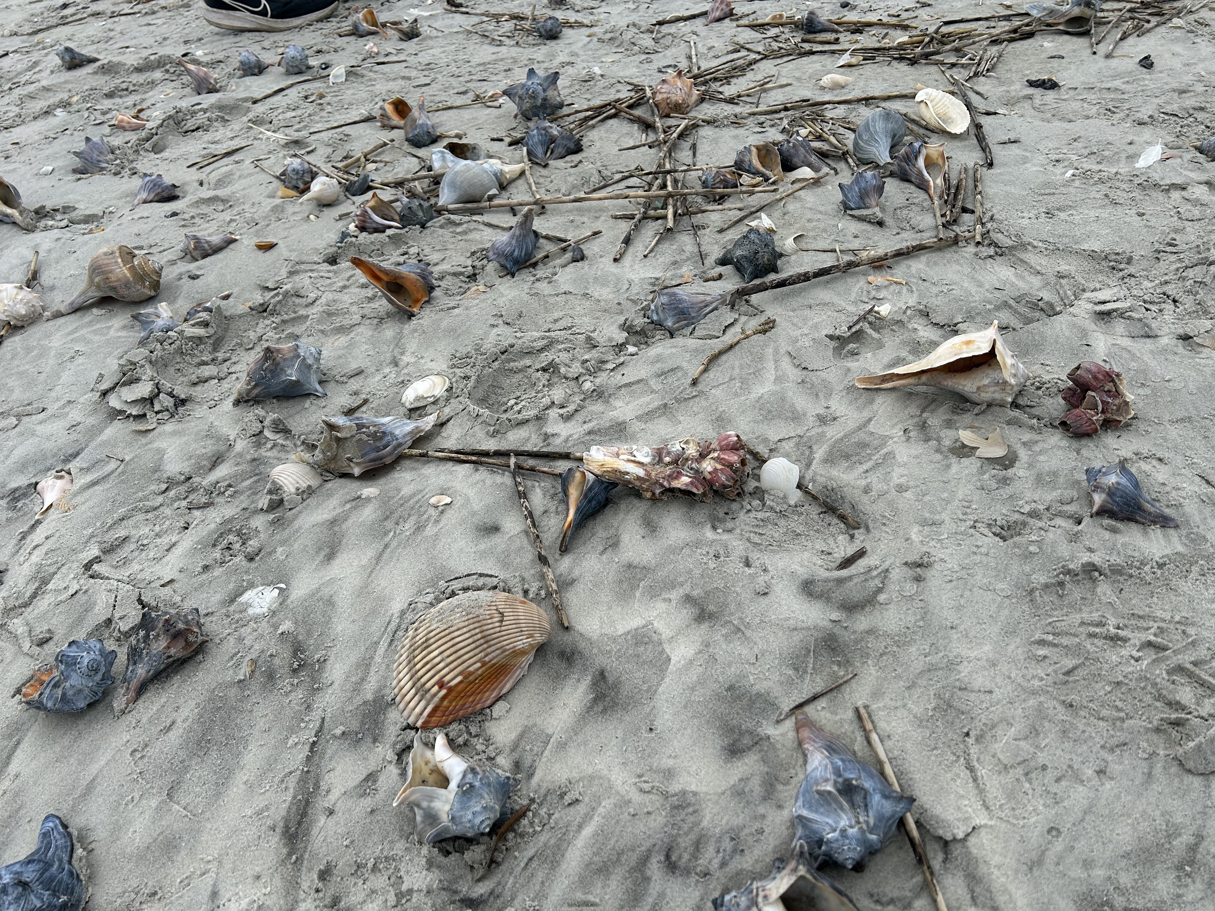
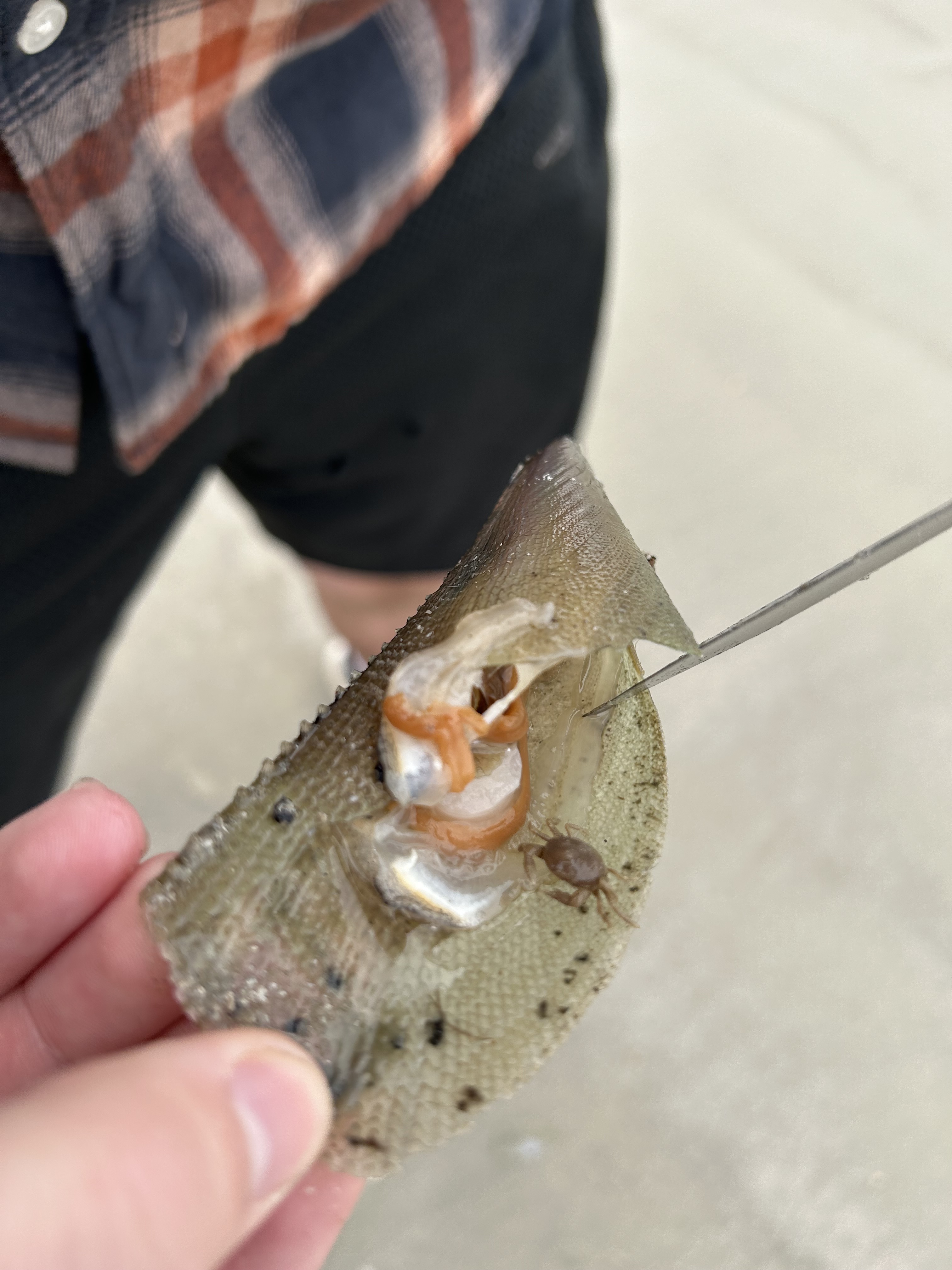
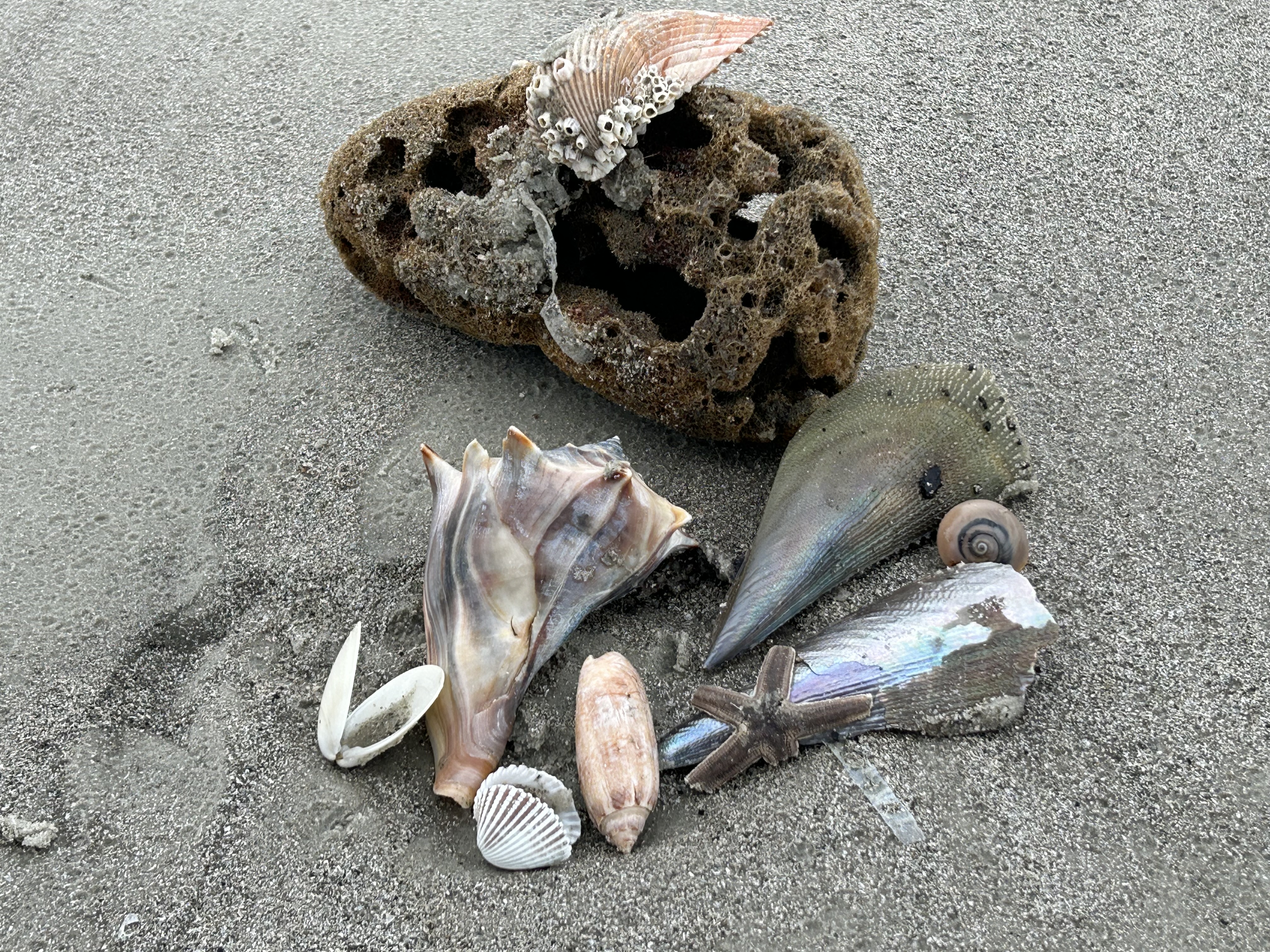
After a short rest and water, we headed down a boardwalk and over the dunes onto the beach. Our exhaustion vanished and the sun came out for awhile. We were the only people in sight on the massive natural beach. We wandered for a good hour gathering shells and enjoying the sea air. Brandon found a bivalve-type shell that he thought might have an oyster (but only had a tiny crab). We took pictures of our findings but left most of them (as they surely wouldn’t survive the backpack). We did bring back two of the coolest (empty) whelks. Although we could’ve stayed all day, we knew there was still a little bit to go before making camp. We went back to the Stafford Campground bathroom area and enjoyed the chance to sit on the decking and have some lunch. (Every day we had bagel sandwiches with Goober Strawberry.) Once fully revived, we headed back over to the Parallel Trail towards camp.

Exhaustion quickly caught up to me after the excitement of the first stretch and the natural high of the beach excursion. We also discovered that we had an extra mile than expected upon realizing our initial planned trek in was not the advertised 5.5. miles but it was actually 6.4 miles using the trails (apparently the 5.5 is if you went on the service road). 

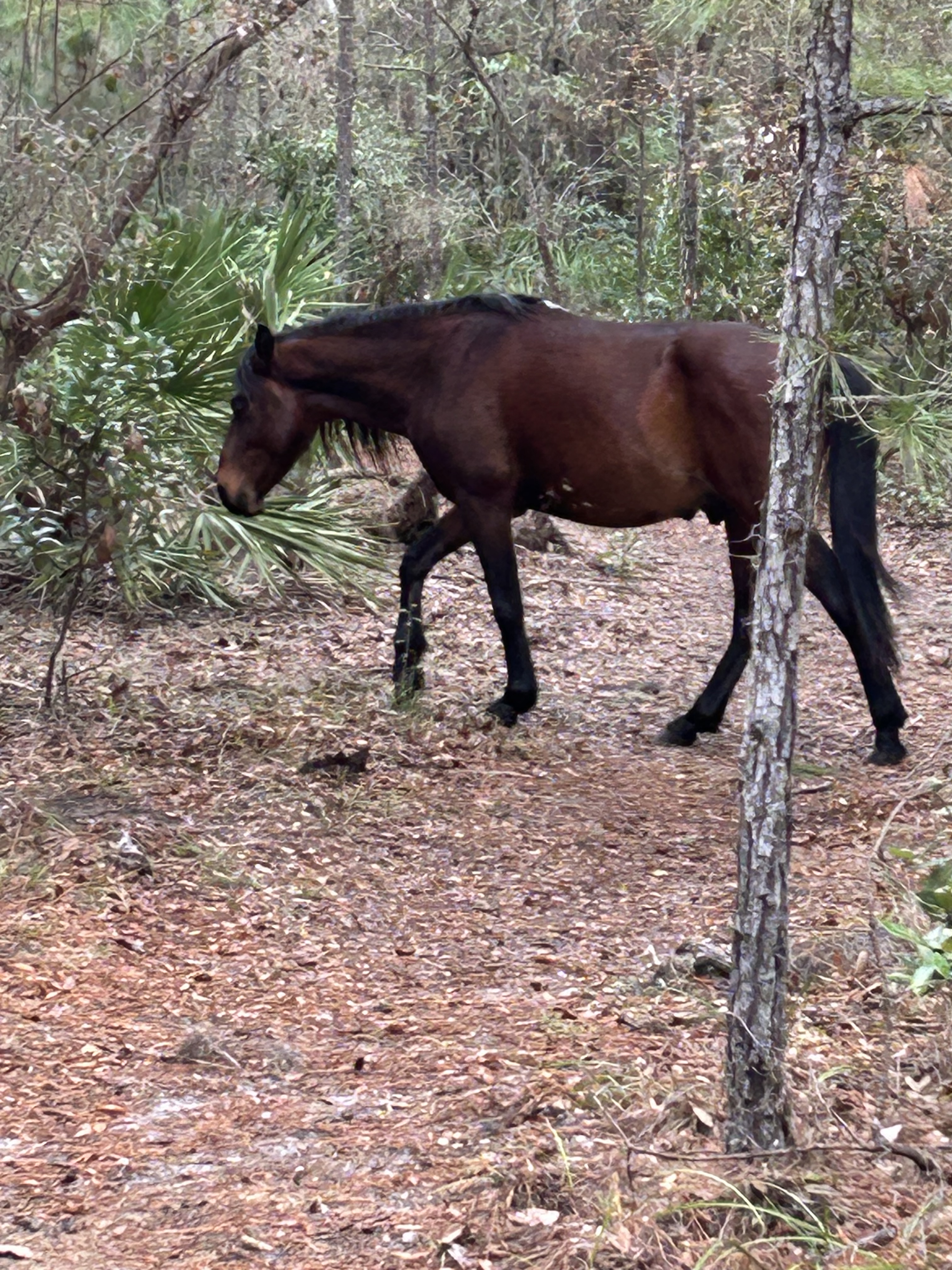
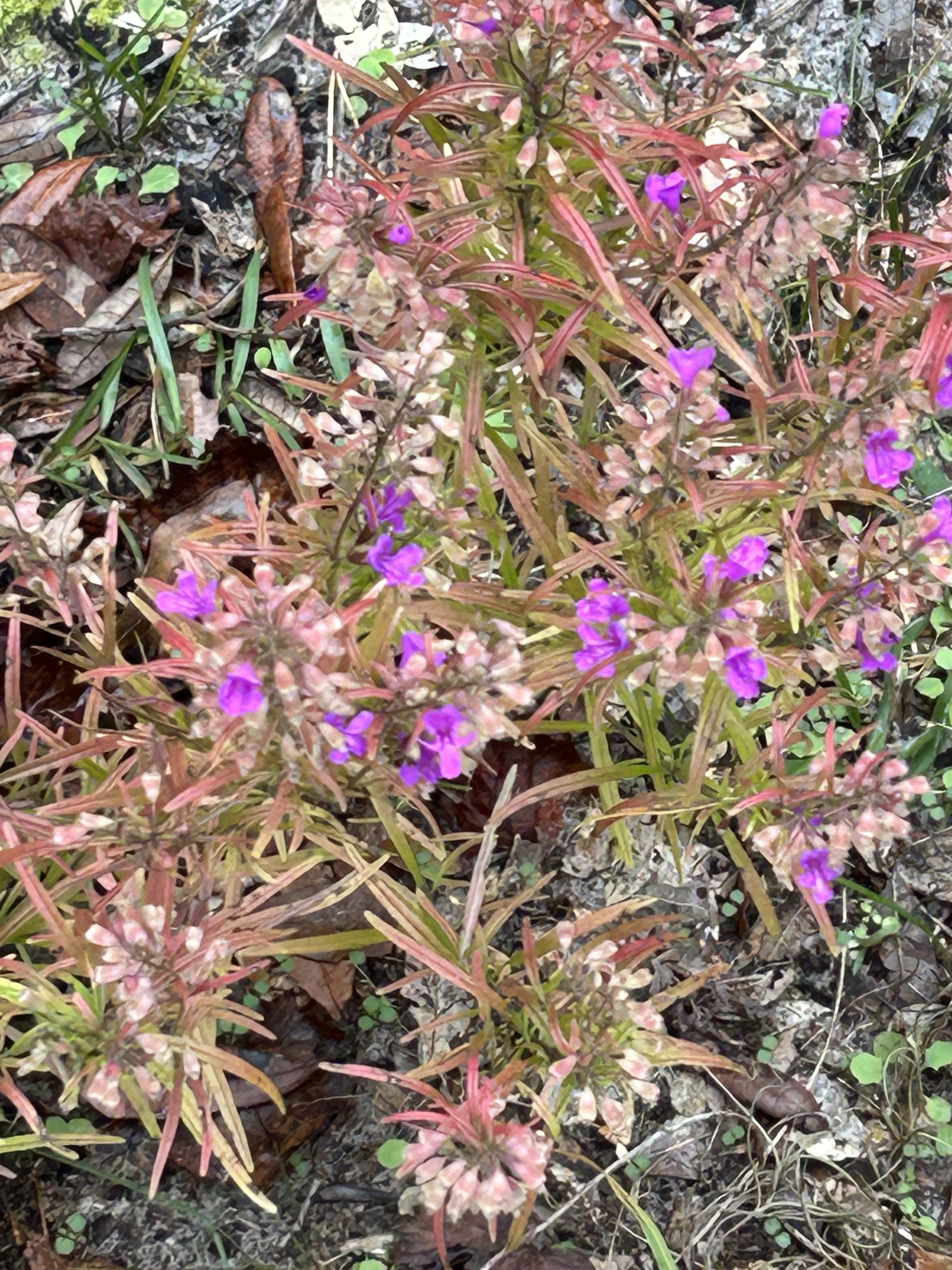
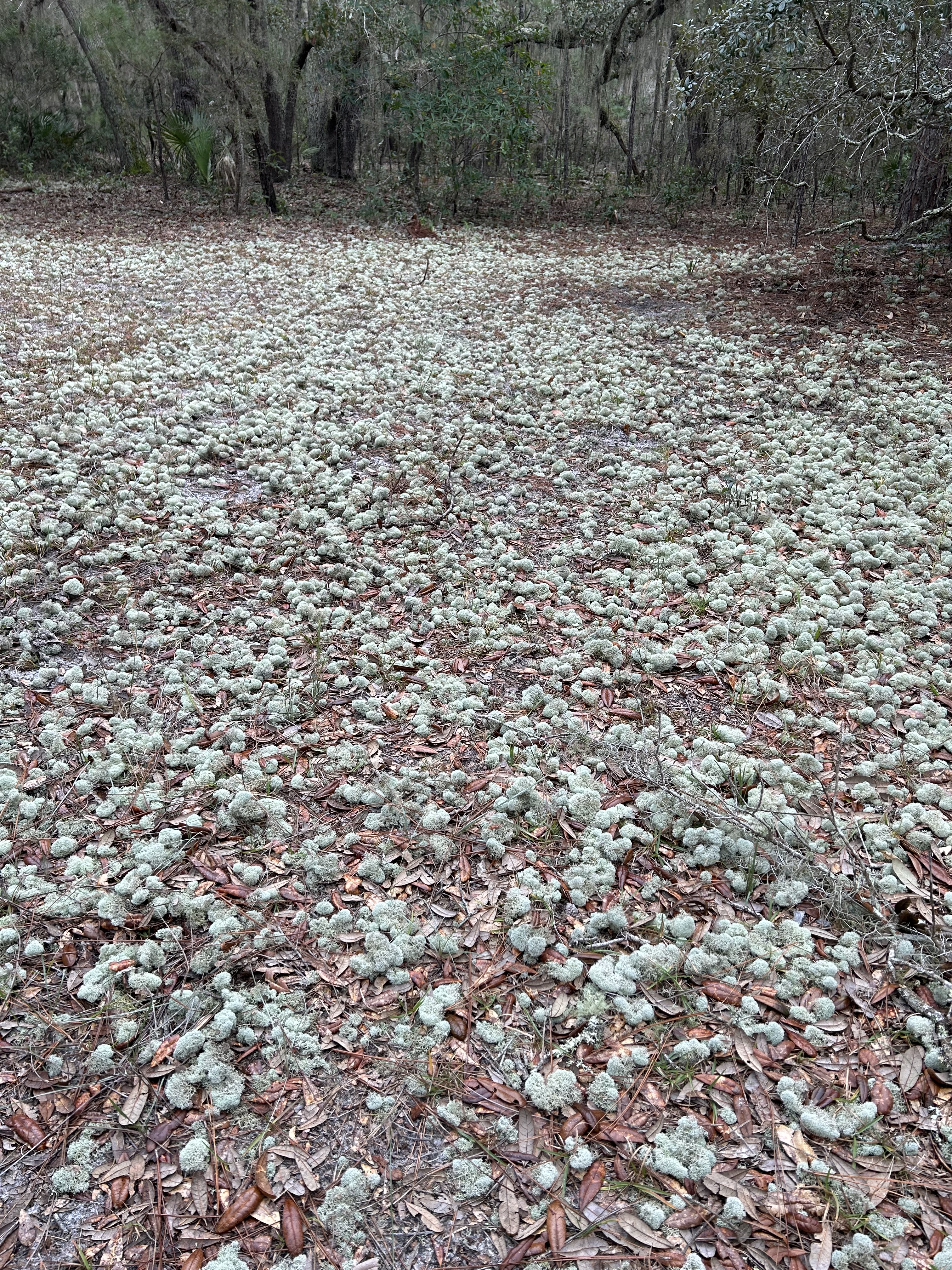
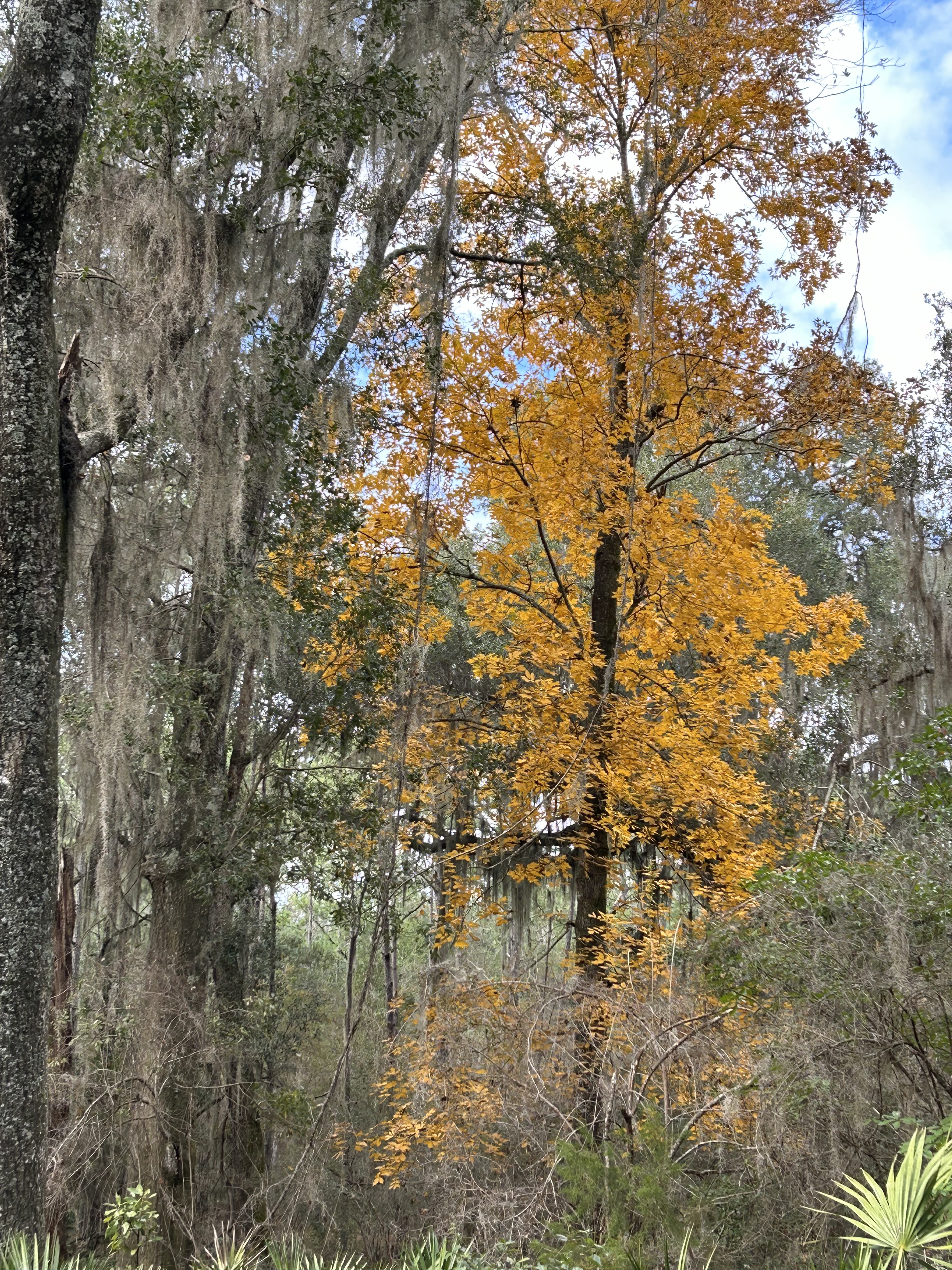
We enjoyed lots of new sights on the last stretch of the day: An oak with a horizontal low limb that stretched almost like a board over 25 feet, a field covered in tiny little moss balls, plants in a sunny area that looked like we jumped ahead to spring, a shady area with lots of golden trees that felt like we traveled back to fall, and wild horses. The horses were eerily quiet and would just come out of the trees and onto the trail in packs. There was danger hidden behind their beauty, so you just had to wait for them to move on. They were also way bigger than you would think–many of them would be approaching eye-to-eye with Brandon (who’s 6’6″) and many were quite muscular. 

While all this was amazing, it was fighting against my discomfort. Brandon taught me how to alternate my weight distribution between the shoulders and the hips, but I found myself constantly adjusting, questioning if we missed a turnoff, and wondering if I would make it to camp. I finally halted us and tossed the dang backpack on the ground. I know, stopping just makes it harder, but I felt done. I was pondering just setting up camp right there in the middle of nothing because I didn’t know if I could go further. Brandon was patient and encouraging while I had some water and a brief mental breakdown. Then we heard the most awful howling & screeching noise I’ve ever heard. I knew it must be the wild boar and it didn’t sound terribly close, but it was enough to motivate me to put the backpack back on and hustle away. Ironically enough, we rounded two more turns in the trail and found ourselves at our camping area, Hickory Hill.

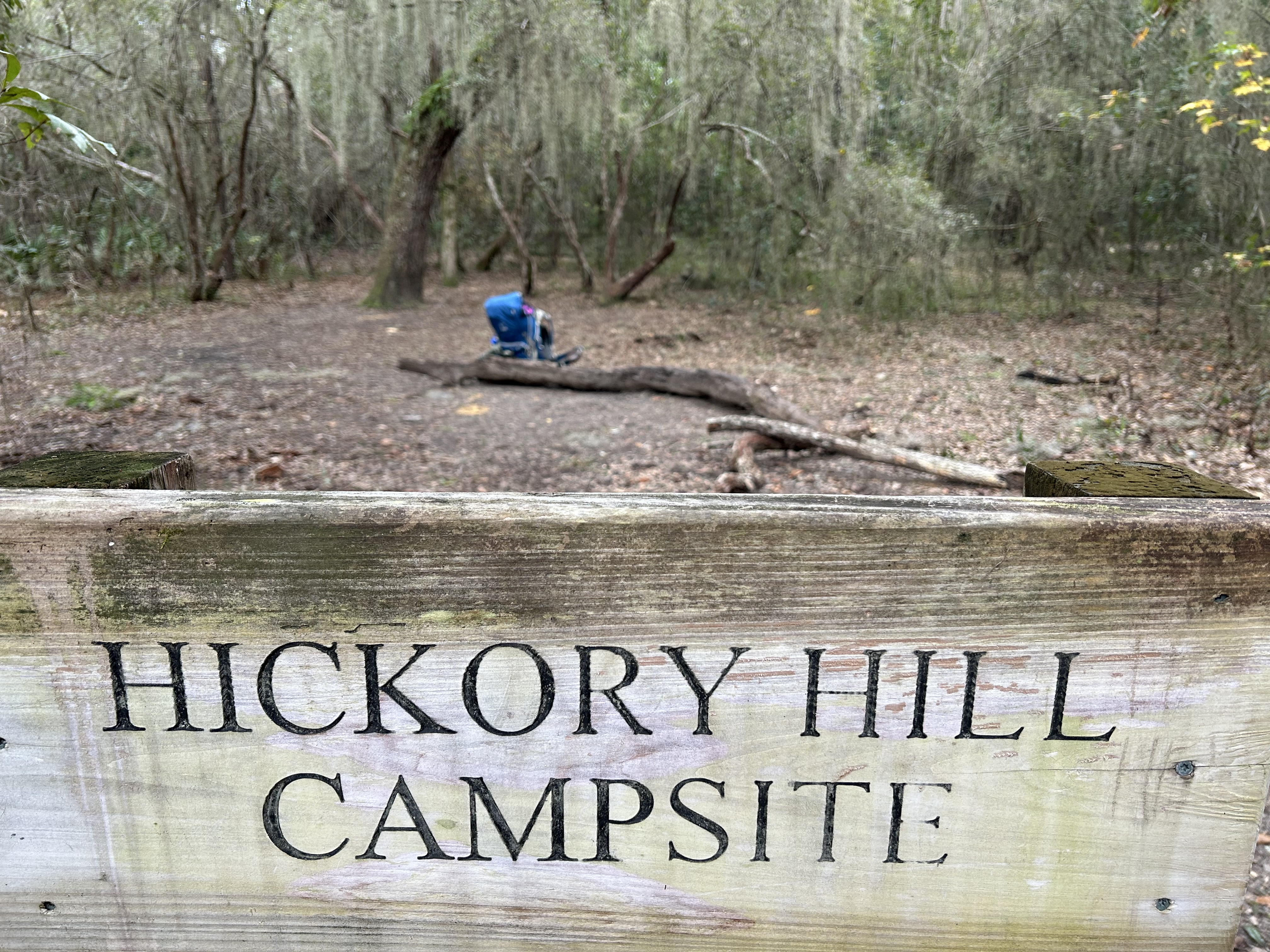
Campsite is some loose terminology for this area of the wilderness. There were a handful of semi-cleared spots in the general vicinity. Tired as we were, we knew we had to set up camp since darkness would come early. We found a spot (just beyond the camp sign) that had: no tree stumps, no anthills, no animal footprints, and was surrounded by a low canopy of bent tree branches. So, we set up the tent and Brandon rigged up the bear bag. Then we discovered a big mistake in our day. A hiking crew that we had run across back at the Stafford Camping area came by and asked if we left a large Berry water bottle. Yep, we left our biggest water vessel 3 miles back. Sadly, but understandably, no one brought it with them, and we weren’t trekking 6 miles roundtrip at dark to get it. This led Brandon to promptly crash laying half in the tent for a bit. I already had my moments of frustration, so I left him alone and scoped out our area to be familiar with the nearby trail crossings and to find the “perfect” bathroom spot that I would inevitably need. (More on that later) We didn’t have the luxury of chairs, so I sat on a nearby log until that got uncomfortable and then just sat on the ground. I was mesmerized watching an armadillo scour the bushes all around our camp until I realized the sounds of the forest were turning to evening sounds and the sun was nearly gone. So, I woke Brandon up to have dinner while there was some light. Our little camp stove worked great and he made some delicious chili ramen with beef jerky pieces. Thanks to Alex’s suggestions, we took a little chocolate (a box of Raisinets) and thus had a little something sweet both nights. We took it as a good sign when I got a heart-shaped one! 

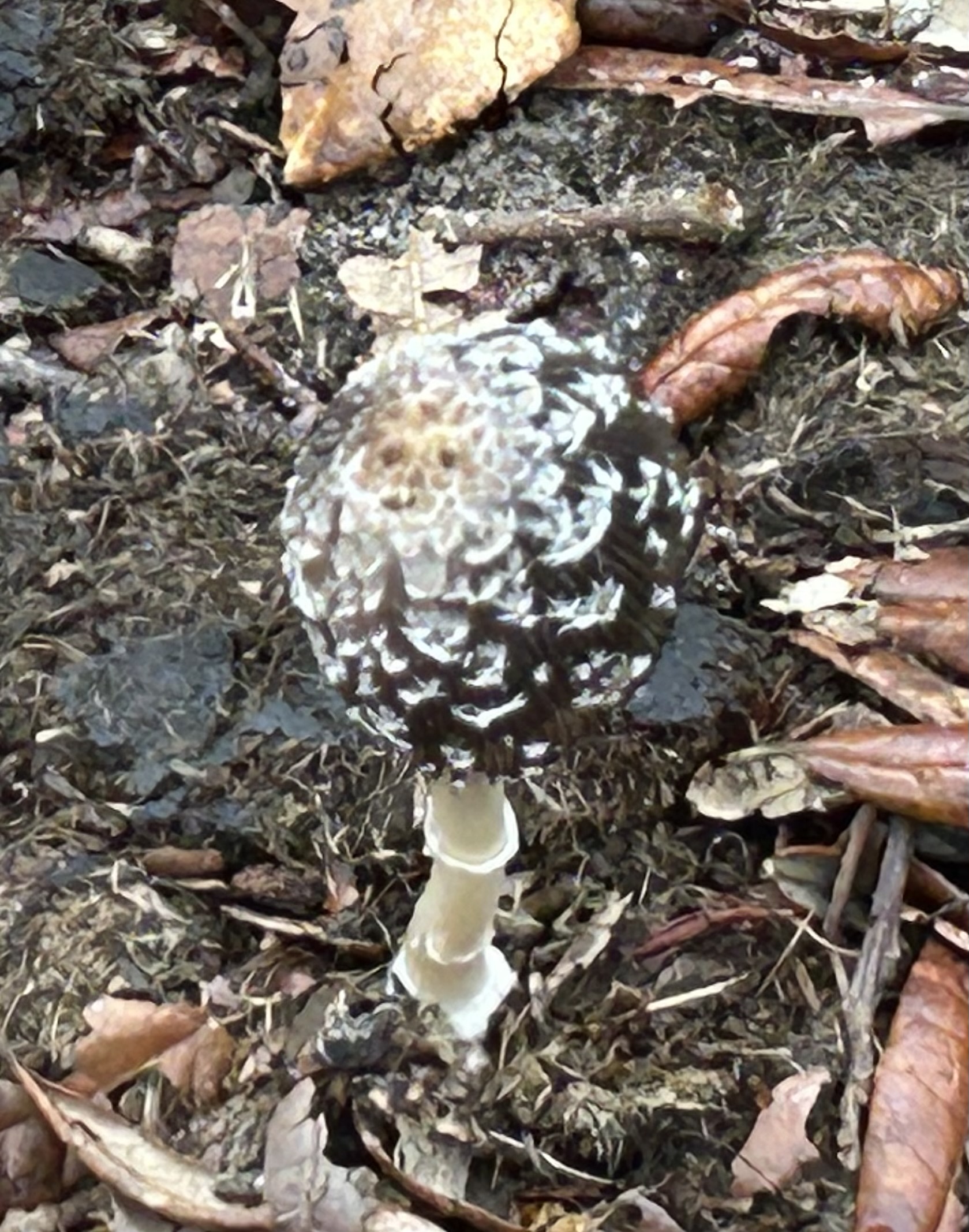
As the sun set, the clouds went away and the temperature went down. Since you can’t have fires in the wilderness section, there was nothing to do but go in the tent (at like 5:30pm, lol). The nearby group went on a night hike over to stargaze at the beach, but I couldn’t fathom the 2 mile roundtrip in the cold dark. We spent awhile smashing mosquitos (they apparently were around in the cool weather and filled up the tent while we were setting up). Then we sat talking with the flashlight until sitting on the ground became tiring. Then we settled in way too early for a way too long night that was chillier than expected at 40 degrees. While physical discomfort was part of the scene, we made the best of it with some great conversations. We reminisced over the highlights (and low points) of the day. We congratulated ourselves on 8 miles of backpacking that day and talked about plans for the next day. We marveled over the fact that there were mushrooms of every color and noted that some of them were reminiscent of the Last of Us, which sparked a whole conversation about the what-if of some apocalyptic event happening from our mushroom exposure that day. After the Covid experience on my cruise in February 2020, it feels like any crazy thing could happen. We finally fell into that realm of half sleep and nonsense talking to your tent mate. I think we both woke up dozens of times in the night to animal sounds, moonlight, the cold air, and the sound of big winds moving in. It wasn’t so much as restful as it was a time to be tired in other parts of your body. Yet we had completed day one and had each other, so it was good in a different way.

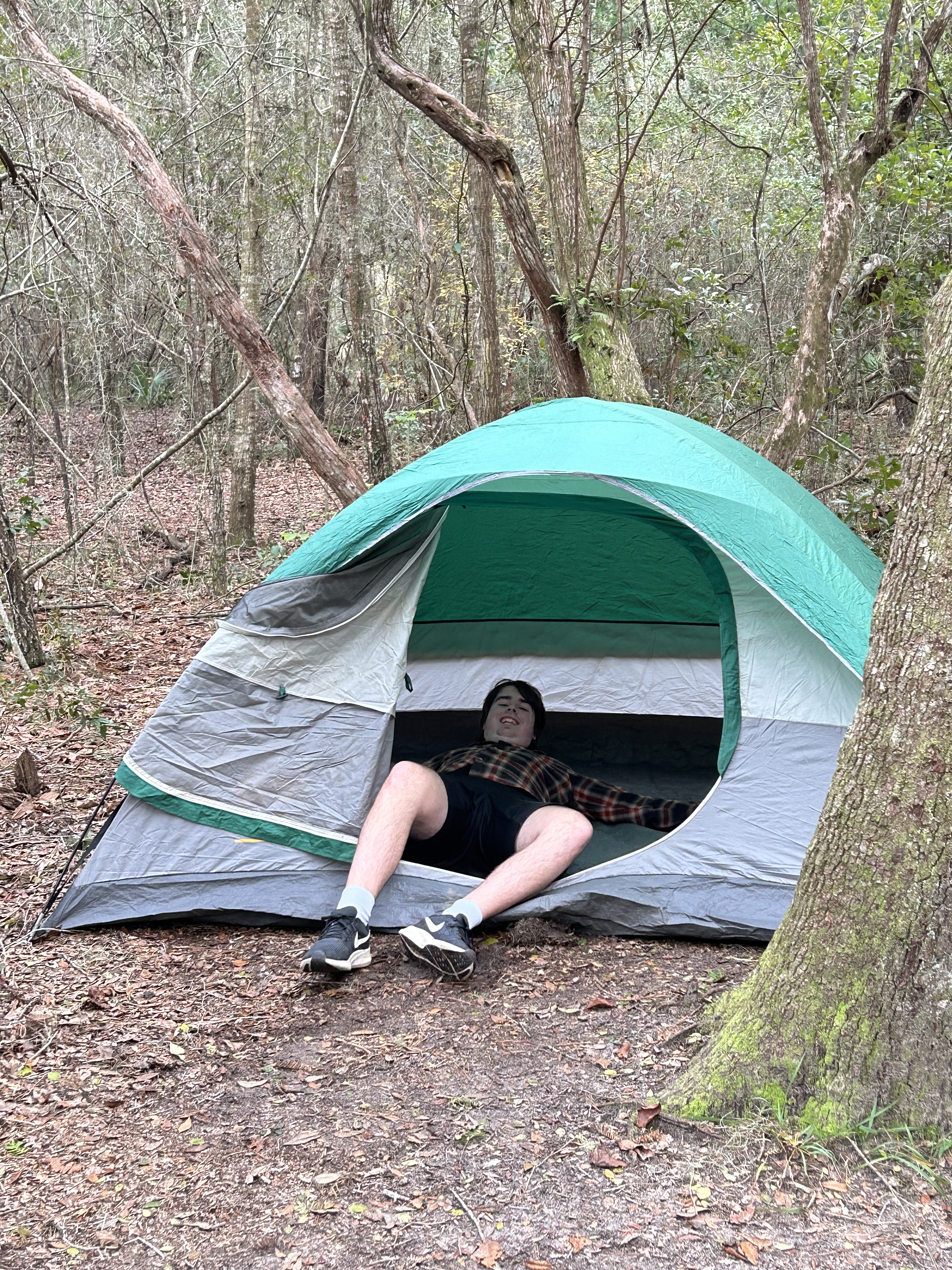
Side Story: If you’re squeamish or not a fan of bodily function discussions, just don’t read this last section. Come back later and read about day two. Otherwise, I have to address the elephant in the room. First, because anyone close to me knows it was my biggest worry. Second, because maybe my experience will help someone else freak out less. I’m not so girly that I’ve never peed in the woods. However, I generally try to avoid that experience at all costs. Until recently, I’ve never had to experience anything more than peeing in the outdoors. However, I was hyperfocused on the disasters that could be part of having to handle all of nature’s functions out in the wilderness. I asked women hikers I knew, and I dove into the Reddit holes of women in the wilderness and decidedly wasn’t ready for all of the stuff some women were embracing. However, one suggestion of a Kula Cloth was great. This is an antibacterial cloth with a little hook to put your finger through that you can easily wipe with after peeing. It clips back on itself and clips onto your pack. It keeps you from having to dig/bury toilet paper or from being unclean for days (leading to chafing or UTIs). It stayed with my daypack that had toilet paper ziplocs, women product ziplocs, a trowel, extra headlamp, and hand sanitizer. So, I wouldn’t call that fun, but it worked. I also discovered that leaning my back against a tree was super helpful: it gave support as all my old joint/bone injuries showed up and it helped prevent too much “splatter”. (Brandon was intrigued by all of this and remarked that guys have this process so much easier). I was still worried about number 2, but thankfully (?) I never had to deal with that. Due to my sulfur allergy (and the sulfur content of water in the area), my Reddit friends had suggested two Immodium before heading out on the trip…I think that stopped number two for a few days inadvertently. I was most freaked out about period issues as (of course) my period decided to be late in December despite being regular for years. I only had to deal with this the first day and it was minimal so thank goodness for ziploc bags to pack trash out.  I had been desensitized a little bit on this one before heading on the trip. My November period brought the adventure of a car ride with the only bathroom for miles being closed, and the unfortunate adventure of absolutely having to change a tampon in the woods. I wasn’t prepared for that horror, but I learned that I could survive it. For the record, I still am not thrilled about the outdoor bathroom but it won’t keep me from backpacking again. For your comic enjoyment after enduring this paragraph, here’s a picture of our “Pee Tree” near camp–trail side for Brandon and hidden side for me.

The Grand Drive – Homeward Bound

Our last night away was in the super-cool Hotel Frederick in Boonville MO. The Kelleys had recommended this as a great hotel and area, as well as a halfway point on a two-day drive from Colorado Springs to Kennesaw. We rolled in pretty late last night, but the Brick Room was still hopping with live music. We had to take off this morning before the adjacent town got moving, but the whole area seemed great for wandering, shopping, and playing. I wish we had an extra day for this Missouri to Georgia stretch for more sight-seeing, but work calls us both back tomorrow.

Our main stop for the day was the Gateway Arch in St. Louis. On a short road trip with the kids in summer 2021, we visited the Arch and rode a river boat down the Mississippi. Thom wasn’t able to join us on that trip, and he didn’t really want to go up in the Arch today, as he hates heights (and had his fill of heights on Pike’s Peak). But, you have to stop and marvel at this 600+ foot tall structure that’s the largest arch in the world. Although it’s known as the Gateway to the West, it is (for us) the gateway back east. I walked poor Thom to death in search of the proper park entrance for the Arch, but we ended up seeing the Federal Reserve building, making me think of dad. We left the Arch before it started raining and stopped at Raising Cane’s for a Father’s Day lunch. :)

We thought about stopping in Metropolis (IL) to see the touristy Superman stuff, but the pouring rain shut that idea down. It’s hard to complain about the weather, as we were blessed with mostly great weather for nine days. We had a few showers here and there, but we’ve seen really bad weather right behind us or right before us yet missed the bad stuff.

We were able to enjoy numerous bridges from Missouri to Kentucky crossing more big rivers, including the Missouri River, Mississippi River, Ohio River, & Tennessee River.

As we rolled into TN, it felt more like home than a road trip. I’ve made the Kennesaw to Nashville/Smyrna drive more times than I can count to see family. If you haven’t driven this path, it really is beautiful. The drive through Monteagle goes over the Cumberland Plateau and then across Nickajack Lake. There are some stunning vistas to enjoy if you’re not the driver. It doesn’t seem nearly as large and the road doesn’t seem dangerous now that I’ve been out west, but it’s still an enjoyable stretch of road. As you come off Monteagle and head towards Chattanooga, you get some great valley views and (my favorite part), you get to follow the curves of the Tennessee River for a bit. As we leave TN and into GA, I definitely feel home already.

I think it could go without saying that I’m glad Thom made this trip happen. We were in a weird place in life with the “baby” graduating high school last spring and launching into adulthood. There have been so many changes in how our day-to-day lives operate now that the kids are all doing their own things. (Speaking of which, yes, I know I need to update my profile on this blog!) Thom and I have embraced driving adventures together this year (around home base), and that’s been really good having something we do, just the two of us. While we’ve had a weekend away together here and there, we haven’t really traveled just the two of us on this scale. We’ve enjoyed this trip all the way from months of planning together to the very last moment of this last day.

All in all, we traveled 15 states, 7 of which I haven’t been to before. We crossed the Continental Divide twice and crossed most of the major rivers in the country. We saw car tags from all the states except Hawaii and Alaska although we stayed at a B&B with folks from Hawaii. We spent over 100 hours in the car, either traveling or sight-seeing. We drove right about 5000 miles over the past 10 days. We laughed over the different GPS warnings across the country (like “roadkill ahead” or “pothole in road”–that last one would go off all the time if people chose that alert in Atlanta). We listened to music spanning many decades, enjoyed hours of podcasts (mainly “A History of Rock Music in 500 Songs”), and connected with one another through great conversations. I got to take pictures and write & Thom got to drive the Mustang. We had nearly all our preconceived notions blown away. We found beauty along many roads (okay, but it’s true that Kansas, while pretty, became monotonous fast). We also met amazing people all along the way. We basically experienced three seasons and an incredible amount of variety in the geology and landscapes. So many moments were beautiful and breathtaking.

It truly was grand–an epic journey with the love of my life. Here’s ’til I travel again.

The Grand Drive – Heading East

It was so nice getting to stay two nights in one place, and the “Bed & Brunch” place we stayed at was pretty cool. We stayed in Casita #2 but spent most of our working hours in the common area. They encouraged the communal living space, even more so than a traditional B & B. It also embraced the CO legalization lifestyle, so there was a “munchie bar” 24/7 and hors d’oeuvres at 4:20 every day. The munchies included typical packaged snacks but always also had fruit, warm cookies, and/or homemade danishes and muffins. There was also always french-press teas and coffee. They had a chef managing a huge kitchen that was open to a large bar, table, and living area. As best I could tell, Chef (as everyone called him) was always in the kitchen tending to anyone’s needs as well as being a social director of sorts. Whether it was 8am or midnight, there was always a group hanging out talking, playing games, working on a puzzle, etc. As you can see below, we ate well at this place that felt like a home away from home. If we’re ever out this way again, we would definitely stay here again for a few days.

It was certainly hard to leave, as these last two days are mainly about getting home. We lingered at breakfast too long, so we didn’t make it to Spicin’ Foods in Kansas City before they closed (to get some hot sauces, including Da Bomb–featured on Hot Ones). However, we had some fun along the long drive. We marveled at how quickly the Colorado landscape changed from massive mountains to farmland or prairie. We got to see windmills again and, once in Kansas, saw oil drilling stations peppered throughout the land. We had a delightful picnic at the Kansas welcome area, featuring some fresh cherries right off the tree (from our first B&B in Colorado). I hadn’t made the Kansas/Wizard of Oz connection for some reason until we saw the feature in the rest area. So, of course, I had to get a photo with Dorothy and the gang. (I tried the whole heel clicking thing to get home, but it didn’t work. Must be the shoes…)

Our last adventure of the day was to acquire Kansas City BBQ. The welcome center had recommended Joe’s Kansas City Bar-B-Que, so we headed there. It had a line wrapped around the outside of the building, so we settled in for a wait. After about a half hour (still waiting outside), Thom got an alert that his car was tampered with. So we stepped out of line to go check things (all was fine…so whoever it was had left without damaging anything). We didn’t want to get back in line, so we decided to try one of the suggestions Chef had made: Jack Stack BBQ. This place was a little more elevated, but the food was amazing. It was almost too good, as we still had 90 minutes to drive to our hotel, in the dark due to all the delays of the day. I highly recommend this place if you’re ever in Kansas City.

The Grand Drive – Pike’s Peak

As we approached this day I got a little worried about Pike’s Peak plans. We had to purchase a time slot in advance, so we had randomly chosen noon. However, the forecast was worse every time I looked at it, and they were calling for snow storms (with 3-5 inches of new snow) up top by noon. So, we decided to go earlier in the day (and just hope they’d let us go in earlier than our slot).

We got up in the morning and the sun was shining-yay! We called the info number, and they said the top third of the mountain was closed for ice and snow showers were expected to start after 10am. Well, we decided to eat breakfast and go anyway about 9:30–hoping the top would be open and it wouldn’t be snowing yet. Things mostly fell into place. They let us in earlier than our ticketed time because it wasn’t too crowded. They had cleared the roads, and it was open all the way to the top (but they told us to go straight up without stops because they couldn’t be sure how long the top would stay open.)

We left Manitou Springs at 6500 feet and worked our way up the mountain. Even going up, it was a bit terrifying albeit exhilarating. We went from partly cloudy 60 degrees all the way up 19 miles to 14,115 feet and mostly heavy clouds at 31 degrees.

The summit was covered by snow–so much so that most of the information plaques were partially buried. They had tunneled out walkways so you could slip and slide to overlooks. We had some of the famous donuts at Pike’s Peak Summit House and enjoyed the visitor center before heading on. There was periodic blowing snow, and the views changed quickly on the overlooks from full clouds to little clear spots peaking through. I had to grab a handful of snow (because I’m an overgrown child) and it was the perfect snow–easy to pack, fluffy when loose, and super sparkly.

The drive down was intimidating before we even started. We had just gone up, so we knew about the many sections with no guardrails, steep drop-offs, and deep descent. However, we felt a little better seeing a Ford Model A and a school bus on the road. (If they can do it, so can we…right?!?) It also helped seeing the snow plow and treatment vehicles continuously running.

Part of the drive down definitely was intense. At first, it was clear. Then some snow blew by. Then thin clouds covered the road. Then thick clouds covered the road. There’s no pulling over or stopping–you’ve just gotta continue forward. Of course, this thick cloud moved in for miles 16 down to 13…which happens to be the most challenging stretch of road. There’s no way you can feel the same intensity through my story because you know (since you’re reading this) that we obviously didn’t drive over the side of the mountain. We didn’t have that certainty at the time.

Despite the few scary moments, it really was a gorgeous ride. I understand how these views inspired the song “America the Beautiful.” Feeling the temperature change (since my window was down for picture taking), watching the sky change, marveling at the change in elevation, having snow blow across my face in mid-June….it was all exhilarating and made me remember how small I am in this big world.

Its hard to write anything after that, but the day did continue. We left the Peak and had lunch at In-N-Out Burger for the first time–cheeseburgers, milkshakes, and animal fries. It was surprisingly great; maybe someday they’ll open some in the east like Whataburger did. If you get a change to visit one out this way, definitely do it, as everything was really fresh and delicious.

After lunch, the skies were darkening and storms were imminent, but we pressed on for the Garden of the Gods. We did the driving tour and the visitor’s center while it drizzled some. I was able to get out at a few spots where there were short walking paths and take pictures of some of the rock formations. I would love to come back here someday and just spend a (nice) day wandering all the trails. Side note: I did see a rattlesnake at one of the rock bases. I didn’t take a pic–I just went the opposite way as fast as possible!

The Grand Drive – Driving CO

Our stay in Clifton was simply delightful. Right out the back door was a view of the Grand Mesa (which is the largest flat-top mountain in the world) and a view of several other nearby mountains. We were also blessed by eggs benedict for breakfast featuring fresh eggs from the friendly resident chickens.

Our first stop was Black Canyon of the Gunnison. This was highly recommended by my dad (so I don’t ignore all his advice). The park elevation is over 8000 feet and the Gunnison River is over 1800 feet below the top rim. Despite that distance, you can hear the river roaring below. I can only imagine how loud the river is when hiking lower in the canyon. There were lots of birds flying around the canyon, from little purple dippers near the trail to peregrine falcons out patrolling the canyon gorge. I only wish we’d had more time here; I’d love to come back in the future to camp, hike, and see the stars.

As we headed east towards Manitou Springs, we experienced more of the stunning lush mountain views like we witnessed yesterday. Along the way, we encountered construction on Highway 50. For five miles, we experienced a one lane, hard pack gravel road where we got to see the incredible work that goes into roads that endure harsh winters, flooding runoffs, and rock slides that take roads out with one drop. You should’ve seen Thom’s face when we saw the sign that said “pavement ends”–nothing like off-roading with the Mustang.

While we waited our turn for the one lane section, we got to witness the wild Colorado weather. It was a beautiful, sunny day with a few clouds, but then we watched a big cloud in the distance moving our way and you could see it snowing up high, then raining as it moved towards us and then over us. The temperature dropped from 65 to 48 in a matter of minutes and then we got pea-sized hail for a good five minutes before it turned back to rain…and then the cloud was gone. Ah, the poor car today!

Part of the drive took us around Blue Mesa Reservoir, which looked almost like the ocean with the wind blowing the water into whitecaps and waves. We were going to have a picnic lunch in this beautiful stretch, but it was 45 degrees and the wind was howling. Rain was moving back in and blowing sideways. So, we went to McD’s in Gunnison for Happy Meals & Guardian of the Galaxy toys, but sadly we got the old swap-a-roo and ended up with a Scuttle from the new Little Mermaid. Hmph

The drive along Highway 50, aka the Loneliest Road, was beautiful from Black Canyon onward. I was so mesmerized that I didn’t really take many pictures and just stared out the window as the miles ticked by. After the drive around the expansive reservoir, we went over the continental divide and around Monarch Mountain, in all it’s snow-dotted beauty at 11,300 feet. As we approached the Rockies, we turned on Co 285, which ran right between the snowy Sawatch mountain range and the Rocky mountain range. We were surrounded by majestic mountains as far as the eyes could see, before crossing the Rockies.

After we checked into our B&B in Manitou Springs, we headed over to Castle Rock (the picture explains the name of the town). We were able to meet up with our niece that lives in Denver, who we haven’t seen in years. We had a delightful dinner at a quaint home-cooking place called the Castle Cafe.

The Grand Drive – Heading North

We left our cute little cabin near the North Rim and hit the road. We drove along the Vermillion Cliffs, through Marble Canyon, across the Colorado River, along Echo Cliffs, and through the Navajo Nation. It was a beautiful ride, especially with the morning fog and the pops of sun as we came out of the canyons.

Our first stop was Monument Valley. It’s so bizarre to see all these individual outcroppings (as opposed to the long canyon walls we’ve been seeing). We only enjoyed the sites around the valley. We didn’t take the 17 mile backcountry drive (gravel and sandy road) as that would be a painful drive for me & the Mustang.

Looking at giant monuments made us hungry, so we found a lunch spot where we could try the much anticipated Navajo taco (aka fry bread taco). This was the best thing I’ve ever eaten! Thom went with a burger in blue corn fry bread with green chili, and it was also delicious. We need fry bread tacos back home!! With full stomachs, we continued onto the next stop.

I don’t often ignore advice my dad gives me, but today I had to go rogue for just a few minutes. We simply had to stop at the tourist trap of the Four Corners. We’ve actually been to all four states (since Monument Valley was in Utah), but that’s not the point. I just can’t resist the cheesy experience of existing in four states at once. And don’t message me about how the lines aren’t quite right…I know all that but choose to be blissfully ignorant.

Next up was a scenic drive through western Colorado. We took the Unaweep Tabeguache Scenic Byway up to Gateway and almost all the way to Clifton, where our B&B was located. The canyon walls, plateaus, mesas, buttes, and spires continued (as we’d seen in New Mexico, Arizona, and Utah). I didn’t realize, before taking this trip, that this whole region was the Colorado Plateau and would have such common features. However, each area had it’s own nuances and beauty. We went through a section with lots of pink mesa, and it was cool to see that the bottom of the clouds were reflecting that pink. We entered a large area called Disappointment Valley, which was such a misnomer–we were surrounded by stunning geology as far as the eye could see! Pretty soon we realized this road was following alongside the curves of the San Miguel River. Turn after turn, we marveled at the sights, watching as the land and walls became more and more lush. We had the road nearly to ourselves, but did have to be careful, as there were cows just hanging out in the road several times. (Side note: we saw cows grazing right on the edge of cliffs. How often does a cow just fall off the cliff???) While there are lots of scenic routes I haven’t taken, I’ve been on quite a few, and I’d have to say this is the most beautiful road I’ve ever traveled.

The Grand Drive – Last Push West

Before leaving Albuquerque, we headed to Piedras Marcades Canyon. I got a two mile hike in, discovering petroglyphs, while Thom got a checkup on the car. It was amazing to be a mile out into the desert. I couldn’t see or hear anything but nature for awhile. It was really cool to see the petroglyphs placed here by the Puebloans 500-700 years ago. Many are fading from the sun, wind, and rain, so it was good to see this piece of history before it’s gone.

Next up was the Petrified Forest National Park. This place blew my mind and far exceeded my expectations. It’s hard to imagine how the Grand Canyon could beat the multitude of views this park offered. We picnicked in the painted desert section of the park. For the second time today, I marveled at how the sun was beating down on me and felt delightfully warm, yet I wasn’t hot. I guess there’s something to that whole humidity thing being the problem.

We drove the 28 mile road through the park, stopping at overlooks and marveling at how each curve in the road seemed to bring about an entirely different landscape. Of special note was the Painted Desert, Newspaper Rock (where you could see hundreds of petroglyphs through binoculars), Blue Mesa, and the Crystal Forest. The drive was made even more fun by the Gold Rush Rally going on–we saw millions of dollars worth of sports cars including Corvettes, Lambos, Porsches, Ferraris, Mclarens, Ford GT, and maybe a Pagani Huarya. On the last leg of the park, we came upon a dust devil. I took a quick picture (which doesn’t do it justice) and then it traveled right over the car!

Continuing west, we were going right past Winslow AZ, so of course we had to pull off and take some pictures. Thom also made sure to get a pic of a “girl in a…Ford making eyes at me.” :)

We got checked into our Sky Dome at the Clear Sky Resort (coolest place ever) and then headed to the Grand Canyon South Rim for sunset and the annual Star Party. I had done some research and decided we wanted to go to Hopi Point for the sunset. We were going to have to find parking, get to one of the bus lines, and ride a bus over. However, in talking about our plans at the resort check-in, one of the guys gave us a code to get in the gate (so we could just drive to Hopi Point). We gathered picnic items and headed out to the canyon. I have to say, when we got out at our spot on the canyon, it was so beautiful that it was truly breathtaking. For an hour, we got to watch rain clouds go over parts of the canyon and we got to see various stellar moments of sunset (despite some heavy clouds). Since we drove, we got some pics of the Mustang at the canyon too…before heading off to enjoy the star presentations.

Let the Grand Drive Begin

On New Year’s Day, sitting around my mom’s table, the predictable question went around: “What’s everyone’s plans for 2023?” Thom quickly piped up and proclaimed that he was taking his woman to see the Grand Canyon. This was news to me, but thus the journey began.

I originally had a big “Out West” road trip planned for summer 2020. The kids and I were going to camp across the West for nearly a month, and Thom was going to meet us for part of it. As with many things in 2020, that trip fell apart. Since that time, the Galloway kids have scattered and it’s quite tricky to get us all in one place for a weekend, much less a month. So, I had mentally given up on this trip ever happening. Thom is full of surprises though and often seems to know my inner thoughts that even I don’t know. He decided to make it happen and stated it in front of others, knowing that would keep me from justifying any postponement of the trip (due to money, time, or not being able to do the trip with the kids).

Over the course of the last few months, we’ve gone from idea to loose planning to booking plans. Thom even got me a giant atlas for the planning (as he knows I love a good map). We added Pike’s Peak to the top goal along with the Grand Canyon. We knew we had a max 10 days available and just filled in the schedule with other cool spots to visit and scenic roads to drive.

Today took us from Kennesaw to Ozark, Arkansas (five states in one day!). The first stretch of road was filled with me doing my nails since I ran out of time before the trip but wanted to look my best on this long date. (Shout out to Stephanie Ann Jones and her Color Street Nails. There’s no way I could do my nails in the car otherwise.)

We had some scenic roads in North Georgia, raced a train in Alabama, and crossed the Tennessee River on the way to a new-to-me Buc-ee’s in Athens, AL. Buc-ee’s to Memphis was the Bee Line Highway, aptly named as it was a straight line between the two. There wasn’t much but corn fields and then this weird place in Mississippi called an Attendance Center (that looked like an old prison with a playground out front). Apparently that’s a school??

Our Memphis stop was at a place called Central BBQ. The decor was a fun picnic vibe but with lots of music art. They had Memphis soul music keeping things lively as well. We sampled each others meals and I can say the classic Memphis rubs were awesome; it was some of the most flavorful BBQ I’ve ever had.

We left lunch, passing the Memphis Pyramid and crossing the wide waters of the Mississippi River. (Side note-I failed to blog about my quick trip through the midwest in 2021. We went to the Memphis Pyramid and it was super fun.) We settled in for a few hours along I-40 with an episode of History of Rock Music in 500 Songs. While technically the episode was about the Byrds, there was a lot of discussion of jazz, bebop, and soul–seemed extra fitting for our Memphis visit.

Once we got out of Memphis, we finally escaped the haze coming from the Canadian fires, but quickly entered gloomy clouds and occasional rain. Despite the dreary weather, we pulled off I-40 just east of Clarksville (which randomly happens to be a nuclear evacuation route…good to know?). We also passed Ozone Burgers, which Thom aptly named the Stabbing Shack–it was a run-down building surrounded by these weird creepy trees that were black and had leafless branches reaching straight upward, so like something out of a horror movie (and we never saw trees like this again on the drive). Anyway… we took the Ozark Highlands Scenic Byway up into the Ozark Mountains and then cut west to take the Pig Tail Scenic Highway back south to I-40. We had no GPS signal and were warned with multiple signs that the road was “Very Crooked & Steep”, but that’s the kind of road we love. However, it was raining lightly most of the drive. While wet roads aren’t as much fun, we drove in and out of the clouds in the mountains and through lush forest regions…and we had the road to ourselves. It was a different experience that we expected, but it was still breathtakingly beautiful.

We ended the day in Ozark with dinner at the Hillbilly Hideout (weird location but great food) and a sufficient hotel. The sign says “Luxury Accommodation” but I think that was put up in the 60s. All in all, it was a long, good day. We moved about 700 miles in 14 hours (including all the stops). Time to hit the hay and start a new journey tomorrow!

Travel America – Homeward Bound

I almost didn’t want to write about the end of our trip because that means it’s over. Yeah, I know how dumb that sounds since it’s obviously over. I just don’t do well with endings. Summer ended (for us) a week ago and school activities have ramped up, so I figure I’ll hang on just a little longer while sharing the last two days of our trip…as we were homeward bound.


We woke up one final morning in Connecticut to that crazy early 5am sunrise (I won’t miss that part). Everyone was sad to say goodbye, as the adults enjoyed renewed time together and all the kids enjoyed getting to really know one another. Deejay and the kids mentioned what we could do “next time” we visited, while the Galloways all pondered the thought that we weren’t sure we’d ever make it that way again. If we do, there are more sites to see and more Just Dance to play.  :)

We traveled through Connecticut, New York, New Jersey, Delaware, Maryland, and Virginia. We payed lots more in tolls and listened to a wide variety of tunes (Prodigy, Phish, the Transformers soundtrack, Guster, Honors orchestra, Toad the Wet Sprocket, the Wreck-it Ralph soundtrack, Allstate high school chorus, and the Nightmare before Christmas soundtrack). Alexander spotted nuclear power plants, Brandon spotted soybeans, and I finally spotted corn. (The plants were tiny though—we were apparently north enough for late harvest seasons.) Elizabeth commented how funny it was that one “piece of land” was shared by Delaware, Maryland, and Virginia…made me think about the Michigan U.P.

We finally approached the Chesapeake Bay Bridge Tunnel, and the highest toll yet. However, this $15 toll was well worth the view (far better than the industrial views in Jersey for a lovely $12 toll). For 18 miles, we traveled along an isolated corridor of bridges and tunnels. There were two mile-long tunnels, going as deep as 75 feet below the water’s surface. The bridges were so long that they didn’t even seem like bridges as you skimmed above the water. Besides the road, there was nothing in site besides a few passing cars, a lone cargo ship, a picturesque sail boat, and the setting sun. We rode along in near total silence, just soaking up the amazing wonder of it all.


IMG_6294[1]


It was hard to reenter reality after that, but soon found our hotel for the night and wandered out for one more delicious seafood meal. The last overnight stay was probably my favorite. This hotel room was a little more spacious, yet we were all still together. Long after crawling into bed, we were all talking about the day and giggling over shadow puppets on the wall.

The last day was celebrated with one last round of hotel waffles and one last effort at packing the car. I suddenly realized that while we had lots of pictures from the trip, we didn’t have a single picture all together. Lizzy came to our rescue and took a good group selfie!

IMG_6316[1]


We drove through Virginia, North Carolina, South Carolina, and Georgia…of course with lots of music (the Connells, the Cure, more Metallica, Jack Johnson, Delirium, and more Phish). We drove past a giant beach chair in Virginia and wondered about an 1800s cemetery in the medium of I-85. Our final meal stop was at the Beacon in South Carolina. We made the mistake of ordering things “aplenty” (with onion rings and fries)…needless to say, leftovers aplenty went home with us!


It really was a wonderful trip. Of course there was tons we didn’t do and see, but that’s life. We all felt like we experienced a lot of our country without being overly scheduled. We made the most of technology (Waze, Gas Buddy, Trip Advisor, Roadside America, and Guess-It), and we made the most of time together. Thom blessed me with the gift of driving, as I got to just enjoy the view much of the trip. I don’t think we’ll ever forget the big things—monuments and our country’s history. I know we won’t forget the little things—silly jokes, crazy selfies, whispers in the night, and even the silence of awe. If you haven’t gotten out and experienced our world in some way, I urge you to do so. Take your spouse, your kids, your dog, or just yourself and experience this amazing world. Whether you experience something new in your community or something cool in a different country, it will change you (for the better) if you let it.

Travel America – New York City

It was the beginning of the “lasts” on this road trip, as this was the last big city we would visit. While we didn’t prepare detailed plans for NYC like we did for DC or Philly, we were still very excited about the visit. We originally thought we’d take the train from Connecticut into the city, as that’s certainly an option. However, it was way more expensive then we planned, so Thom and Deejay worked on an alternate plan. They found a way to get on the Statue Cruise from New Jersey. They also discovered that we could get on in New Jersey and get off in New York (after the tour), but we’d have to find another way back to Jersey…but there were lots of affordable water taxis that would meet our needs. So, we got up early that morning and drove to the big city. We had a harrowing moment (again) when we drove straight towards Manhattan and Thom got panicky for a few minutes, but many fast lefts and rights in traffic put us on the George Washington bridge over to Jersey. I think this was the first double decker bridge we had gone over, and we ended up on the lower level (which was cool but not as scenic).


Parking was relatively easy at Liberty State Park, and the ticket line was short, but there was about an hour-long line to go through security and get on the ferry. (We later talked to people that boarded in New York and found out that their wait was twice as long.) The kids enjoyed the ferry ride to Ellis Island, and it was a fun moment to recall the crazy ferry ride we took at Patriot’s Point years ago when a hurricane was out at sea…this ferry ride was extremely calm in comparison!

IMG_6192[1]


Our first stop on the cruise was Ellis Island, also known as the Island of Hope and Tears. I expected more history on the building, how the island was chosen, and the people who first ran operations at the island. However, the majority of information was centered around immigration—both the stories of places/situations that people were emigrating from as well as the stories of the people once they arrived. It really made us think about our history, as we read about the freedoms and opportunities that drew people in from around the world while also seeing the hard life and poor treatment that many received while getting here and once arriving. It was also striking to see how many of our freedoms weren’t applied to all people.


After our Ellis Island tour, it was time to line up for the ride to Liberty Island. The line wasn’t too long, but we did have to wait about 30 minutes for another ferry to arrive and unload. It was really cool to circle all around Lady Liberty in the boat before landing on Liberty Island. We enjoyed our stroll around the island, taking pictures in front of the statue, and watching all the people around us. It was interesting to see how many groups were there with flags from other countries in their pictures, celebrating their heritage and their American life simultaneously. We weren’t able to go up in the statue at all, a side effect of “going with the flow” and not having set plans in advance. We discovered that, for this time of year, you need to make reservations three months in advance to walk up to the pedestal; you need to make reservations nine months in advance to walk up to the crown. Ah well, it was still cool to see it up close and remarkable to see how very tall the statue is (since it seems dwarfed against the New York skyline and all the skyscrapers).

IMG_6202[1].JPG


We also saw the Liberty Bike, covered in copper, which was created to commemorate the 125th anniversary back in 2011. Before departing the island, the kids all bought a souvenir…they had all been waiting for something here and did a great job hanging onto (most of) their money during the prior week. Then we were back in line (for over an hour) to get on the ferry—this time to Battery Park in New York. On the plus side, we passed the time having a quick “lunch” of hot dogs and soft pretzels.

IMG_6201[1].JPG


Once we got to Battery Park, we walked towards the 9/11 Memorial. It was funny that the kids thought (and Thom hoped) that this area was right off the ferry. Seeing the city from the water, everything looked close, but this area was actually six or so blocks away. It was stunning to see how they had replaced the building footprints with amazing, huge reflecting pools. There were 30-foot waterfalls all around the square, cascading into the reflecting pool and pouring into deep voids. It was mesmerizing and saddening. The shining spot was the rebuilt towers and the lone surviving tree.

 
As we headed out of the city and towards the water taxis (ie, ferries), everyone discovered they were hungry. We didn’t believe a dinner in the financial district would be very affordable, and no one wanted another hot dog (mainly because the street vendors were cleaning their carts and the smell of cleaning products and hot grease from the day was less than appetizing). We decided to push dinner back until we got to the car, and instead stopped at a smoothie stand. I bought one to share, but the kids all decided to buy their own after tasting how amazing it was. Thom & I got to enjoy ours while watching the kids make decisions on how much to tip. We also got a culture lesson as one of the smoothie truck workers left, pulled out a mat, and went through the motion of prayer right there next to the road. Smoothies in hand, we hopped on a ferry and enjoyed the late day ride on the water.

IMG_6236[1]


Dinner was later than planned because we dared not look for food until safely past any chance of driving into NYC. We all agreed on Mexican food and located a well-rated place in New Jersey–El Bandido. The food was great, the place was packed, and the service was shockingly fast. While the entrees were a little pricey (compared to normal restaurant Mexican combination platters), they slapped down free mini cheese quesadillas and a loaded nacho chip for each person, in addition to the chips and salsa. The party atmosphere filled with loud music precluded any conversation, but we just enjoyed the experience. It was especially funny when the mariachi musician (one guy with a guitar and an ipod playing the other parts) came to our table, stood across from Elizabeth, and sang La Cucaracha (btw, she hates all bugs, but especially roaches). As the meal finished up and we got the bill, we were about to get up from the table when they delivered a complimentary dessert…some sort of cross between bananas foster and sopapillas. It was a crazy (and delicious) way to end the night.

IMG_6238[1]

Reflections: Brandon really liked the Statue of Liberty, and enjoyed the immigrant stories of how happy they were to see the statue. Alexander liked hanging out with Deejay and his kids; he also loved the ferry ride back in the evening. Elizabeth enjoyed looking through all the immigrant artifacts in the Ellis Island museum, and loved the Mexican place with all the freebies. Thom found the most meaning in the 9/11 memorial since it’s something that’s been part of our lifetime.